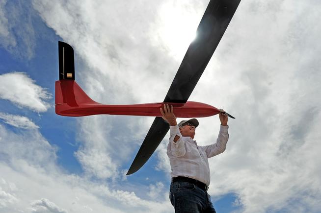
Photo by AP Former Navy helicopter pilot and San Diego Gas & Electric unmanned aircraft operator Teena Deering holds a drone as it is prepared for takeoff near Boulevard, California.
By Donna Mahoney
The Federal Aviation Administration has granted more than 1,000 exemption approvals for drones in its effort to safely expand their operations.
The 1,008 Section 333 exemptions include grants for “new and novel approaches to inspecting power distribution towers and wiring, railroad infrastructure and bridges,” the FAA said Aug. 4 in a statement.
A report published July 30 by the Arlington, Virginia-based Association for Unmanned Vehicle Systems International highlights some of the innovative ways unmanned aerial vehicles, more commonly known as drones, are being put to work, including inspecting industrial flare stacks that stand several hundred feet tall and emit 2,000-degree-Fahrenheit heat.
Building contractors also can use drones to inspect work being done on roofs instead of asking workers to climb up and do it, while civil engineering contractors can use drones to inspect bridges, towers, and wind turbines without putting people at risk to do so, the report says.
“With the FAA offering 333 exemptions to companies, they are able to use unmanned aircraft with optical (traditional), thermal/infrared, even gas-detection (leak) sensors,” a spokesman for Morton, Illinois-based unmanned aerial vehicle manufacturer Homeland Surveillance & Electronics L.L.C. said Aug. 6 in an email. “And since UAVs are so much smaller in size, they can safely operate closer to the lines/structures without risking the lives of pilots or infrastructure, all with returning a higher quality data output.”
“Bridge inspections are a hot topic right now because of the amount of failures and concerns we’ve had over the last 20 years,” the spokesman continued. “UAVs can quickly and effectively be used to fly around supports and foundations to show signs of premature wear/damage. UAVs can inspect the underside of decks and roadways — imagine humans trying to get data that close and quickly while being suspended over a rushing river or massive ravine.”
Railroads can also use UAVs to measure changes in track integrity and capture time-lapse data to compare changes over time. Before UAVs, this was done manually by walking or rolling a crew down the tracks to collect the data, the spokesman said.
Utility inspections also are safer and faster with drones. According to a petition granted to Atlanta-based Southern Company Services Inc. by the FAA, drones “would vastly reduce risks to crews responsible for power line inspections and significantly hasten power restoration in the event of storms, hurricanes, tornadoes, and other weather events.”
Five years ago, the risk that unmanned aerial systems (UAS), or drones, might pose to airliners was not a problem on anyone’s radar. Today, the rapidly increasing number of near-misses between the two is ramping up concern in both pilots and regulators.
Increasing numbers of near-misses between airliners and UASs are being recorded worldwide. In January, for example, air traffic controllers at Dubai International Airport – the world’s busiest in terms of international passenger volumes – had to suspend all operations for almost an hour after several small UASs were seen close to the airport. Since then, the neighboring emirate of Abu Dhabi has slapped a ban on all drone sales to the public.
Airline pilots have been startled to encounter drones previously unheard-of heights. The crew of a Republic Airlines flight on approach to New York’s LaGuardia Airport in September 2014 reported passing a drone at 4,000 feet, while last July, a US Airways flight – again, on approach to LaGuardia – reported missing a drone by just 50 feet at the same altitude.
July saw a near-miss between a Lufthansa Embraer E-195 and an unidentified UAV on the approach to Warsaw’s Chopin Airport, and in the most recent incident, two aircraft flying last Friday near John F. Kennedy Airport, came within 100 feet of a drone on Friday.
On July 22, the UK Civil Aviation Authority, as part of the launch of a new code of awareness for UAS operators, released details of close calls involving aircraft and miniature vehicles, including one where an unidentified airline’s Airbus A320 came within an estimated 20 feet of a miniature helicopter hovering overLondon Heathrow Airport in July 2014. The A320 was at just 700 feet, on short finals.
The UK already had a ‘drone code’ that set limits on maximum distances from operators that drones could be operated, but its stipulations are now being re-emphasized. These include a maximum UAS operating altitude of 400 feet and commonsense rules such as not operating UASs near airfields or airports.
Criminal legislation already exists in the UK that can result in a prison sentence of up to five years for anyone convicted of ‘recklessly endangering an aircraft in flight’. This would apply to misuse of drones. (In 2014, the CAA successfully prosecuted an individual for flying a UAS in restricted airspace over a UK nuclear submarine base.)
“It is imperative that people observe the rules when operating a drone,” said CAA Director of Policy Tim Johnson, launching the new code of awareness. “Drone users must understand that when taking to the [UK’s] skies they are entering one of the busiest areas of airspace in the world. When doing so, they must be aware of the rules and regulations for flying drones that are designed to keep all air users safe.”
The CAA has applauded moves by UAS manufacturers to build ‘geo-fencing’ capabilities into their products’ software. Geo-fencing prohibits drones from being flown into pre-programmed geographical areas, such as airport control zones. It can also set altitude limits.In the US, meanwhile, the FAA issued a Notice of Proposed Rulemaking in February setting out new rules for what it classes as ‘small UASs’, namely those weighing less than 55lbs (25kg). These included setting a maximum altitude of 500 feet for UAS operation, keeping the vehicle within line of sight of the operator and daylight-only operations.
Part of the UAS problem lies in the fact that drones are still not on anyone’s radar – literally. Most are so small – and largely made of plastic, to boot – that they do not register on air traffic control screens. So airline pilots have no warning when a mini quad-copter or other drone hurtles past their wing. Whether a turbofan would be able to cope with ingesting a small UAS remains to be seen.
The other main problem is the explosion in the purchase of drones, not by commercial companies – which are generally aware of the regulations to which they must adhere – or to ‘traditional’ hobbyists, who are usually aviation-savvy.
In the past couple of years, small drones have become popular purely as toys and, as such, have been purchased by many people with little awareness of the potential dangers they pose to other air traffic and even less of the regulations governing their new gadgets. A few are likely to even deliberately fly their new gadgets near airports to get the same sort of thrill as those who flash laser pointers at aircraft.
FAA
In May, the FAA announced a public outreach campaign for the area around Washington, DC to reinforce the message that the city itself, and communities within a 15-mile radius of Ronald Reagan Washington National Airport, are a ‘No Drone Zone’.
This followed on from a national campaign in December 2014 when the FAA partnered with the Association for Unmanned Vehicle Systems International, the Academy of Model Aeronautics and the Small UAV Coalition to make sure everyone who flies a UAS during the holiday season and afterward was familiar with the rules of the air. As part of the effort, the FAA created a short safety video, Know Before You Fly, to educate model UAS users on the Do’s and Don’ts of their hobby.
The fear is that it will take a major incident in which people are killed before some users sit up and take notice of the risks inherent in their new ‘toys’. By which time, it will be too late.
Fifteen of the first 500 FAA exemptions permitting commercial drones to fly were granted in Colorado.
But enabling those and other waiting businesses to spur an estimated $232 million in economic impact — and create more than 1,190 jobs — in Colorado by 2017 hinges on long-delayed rules based on a 1946 U.S. Supreme Court case filed by a poultry farmer.
Yes, that’s right. Regulation of high-tech drones in the U.S. starts with chickens.
Under current aviation law, aircraft must fly no lower than 1,000 feet above congested population areas, and at least 500 feet above less-populated areas.
But there are no permanent regulations for commercial unmanned aircraft systems, or drones. The vehicles are illegal to fly in the national air space without a Federal Aviation Administration permit called a Section 333 Exemption. The permit allows drones to fly commercially as long as they fly in daylight, no higher than 500 feet and within the operator’s line of sight.
The delay in deploying regulations that have been discussed for more than five years is frustrating companies in Colorado, and elsewhere, that use drones for such diverse tasks as delivering packages, and surveying real estate, oil and gas wells and farm fields .
Figure 1: For airborne precision agriculture applications, the spectral range most desired is the VNIR, which spans 400 to 1,000 nm. Image: Headwall Photonics Inc.
The push to make food and poultry products safer, more wholesome and more plentiful is leading to new initiatives commonly described as “crop science” and “precision agriculture.” Although there are many facets to these initiatives, the ability to “see” the desired field of view with a high degree of spectral and spatial resolution can lead to many scientific breakthroughs that benefit the global community.
In some cases, the desired field of view can be an entire crop field or vineyard as seen from an aircraft or unmanned aerial system (UAS). In other cases, it can simply be crops or poultry moving at rapid speed mere feet away along a conveyor line. Characteristic of both is motion, which allows a sensor (either multispectral or hyperspectral) to capture frames of high-quality spectral image data that can be analyzed later. A complete representation is called a hyperspectral data cube, which is a stack of images of the same object or scene—essentially an image for each wavelength.
The practical difference between multispectral and hyperspectral primarily lies in the number of spectral bands captured. Multispectral imaging captures between five to 30 bands, with gaps between those bands. Hyperspectral captures hundreds, with very dense and continual spectral information for each pixel in the image. In some cases, one will be more desirable to the other. However, a hyperspectral sensor gives the option of “seeing” everything. Spectral signatures are powerful discriminators, and it’s useful to know when a particular chemical fingerprint is there or not. There are many instances where the granularity and specificity of hyperspectral image data is absolutely necessary.
Hyperspectral imaging has the unique ability to extract meaningful scientific information from the scene or field of view. It allows users to detect the presence of a material based on its spectral fingerprint. It also allows users to classify and separate materials into spectrally similar groups. Discrimination, characterization and quantification are also hallmarks of the technology.
The ability of hyperspectral sensors to exhibit a high degree of discrimination means scientists can classify those disease conditions, and also build an image that faithfully pin points where it is and how invasive it might be. Since the image data is GPS-coordinated and orthorectified during post-processing, the scientific value is significant: irrigation and fertilizing decisions are more precise, speciation is more accurate and crops that might be lost are saved. Indeed, the very same hyperspectral imaging technology that can make existing crop harvests more bountiful can also help survey the land in famine-affected areas so crops can be planted with a higher degree of success.
Since motion is needed for hyperspectral imaging to create a data cube, it meshes perfectly with the rapid growth of the UAS across industry, research and academia. The UAS is more affordable, smaller and lighter than fixed-wing manned aircraft and, thus, is more readily deployable in unforgiving areas of the world. Armed with precise instrumentation, such as hyperspectral sensors, a UAS can deliver truly life-enriching information beneficial on a global scale. Entire economies depend on the success of agriculture: citrus in Florida; coffee in South America; vineyards in northern California. Across them all, UAS with hyperspectral sensors are deployed at a rapid pace.
One common mistake prospective users make is misjudging the work needed to integrate the entire flight/sensor package. Obviously, size and weight matter because a UAS, especially the small hand-launched ones, will typically have a strict payload limit. Hyperspectral sensor manufacturers, such as Headwall Photonics, recognize this and are making their instruments small, light and more integrated. For example, Nano-Hyperspec (Figure 1) is only 3 in x 3 in x 4.7 in and weighs less than 1.5 lbs. But, in that small space sits the data storage chip, and the GPS attaches directly to the sensor rather than connected by cables that take up space and add weight. In addition to smaller and more integrated sensors, Headwall also helps to fully integrate the flight package. This means not only the sensor, but also helping with the UAS, the GPS and, if desired, LiDAR instrumentation. LiDAR is a common add-on for precision agriculture work and other remote-sensing research.
Figure 2: Diffraction grating. Image: Headwall Photonics Inc.
The value of this integration work is a quicker time to deployment and more success with capturing precise image data. This work also turns a basic UAV or “drone” into a useful UAS.
For airborne precision agriculture applications, the spectral range most desired is the visible/near-infrared (VNIR), which spans 400 to 1,000 nm. Most everything worth seeing can be seen in the VNIR range; but occasionally the shortwave infrared (SWIR), from 900 to 2,500 nm, provides useful data. One option is to simply have two sensors capturing the respective VNIR and SWIR image data, both controlled simultaneously by hyperspectral image software. Another is to have an integrated dual sensor package that co-registers the pixels from each sensor, producing data from 400 nm up to 2,500 nm. While heavier and larger than the Nano, it’s perfectly suitable for bigger UAVs and fixed-wing manned aircraft.
The basic design of a hyperspectral sensor is shown in Figure 2. Reflected light passes through a lens, then through an image slit, which allows a sliver of the scene, image to reach a curved concentric mirror. A high-performance diffraction grating then diffracts the reflected light precisely, and without any unwanted artifacts or aberrations, onto a second concentric mirror, which images the sliver of the scene image onto a camera focal plane array (FPA), but with spectral information spread in the direction perpendicular to the slit direction. By recording this spectral data for that one sliver of the scene and repeating this while moving either the sensor or the scene to capture the spectral data for the next adjacent sliver of the scene image, the hyperspectral image of the full scene can be captured. The spectral range of the sensor is dependent on the FPA technology: silicon (300 to1,100 nm), indium gallium arsenide (InGaAs) (700 to 1,700 nm), indium antimonide (InSb) (1,000 to 5,000 nm) and mercury cadmium telluride (MCT) (1,000 to 1,4000 nm). Hyperspectral sensors of this type are often referred to as line scanners, and the design described above is a concentric one. Because there are no moving parts within the sensor, the resulting instruments are robust and stable across temperature.
Figure 3: Aberration-correction is a very desirable feature made possible through precisely engineered diffraction gratings. Image: Headwall Photonics Inc.
Aberration-correction is a very desirable feature made possible through precisely engineered diffraction gratings. The job of the grating is to diffract the light precisely, and this is accomplished by the design of the grating and its groove profile. Gratings can be planar, convex or concave, and the groove profiles are precisely engineered so each grating is application-specific. They can also be engineered in very small sizes, meaning the instruments that contain them are similarly small and light. Figure 3 depicts the basics of a diffraction grating.
The natural tendency is for image degradation to occur off to the edges of the field of view. These aberrations are corrected by the diffraction grating, meaning the entire wide field of view is crisp from one edge to the other. For UAS deployment, this is crucial, because it can actually help optimize the flight efficiency since fewer passes over the field are needed in order to faithfully and sharply capture all the image data the sensor sees.
Hyperspectral imaging isn’t limited to airborne deployment. The technology is also used along inspection lines for high-value specialty crops, such as nuts and fruits, and for poultry and seafood. In fact, the USDA is working with Headwall Photonics to push the science of hyperspectral imaging forward with the goal of improving the inspection accuracy of poultry. The end result is a new technology that delivers higher-quality food products to consumers, while delivering demonstrated differentiation and maximized value to producers.
Thanks to their ability to “see” with a high degree of specificity and discrimination, hyperspectral sensors can spot anything other imaging and vision techniques might miss. The sensors can also “grade” harvested crops in a manner that allows the producer to maximize yields.
An industry group representing hobby model airplane enthusiasts since 1936 has asked federal agencies to stop characterizing their members as the irresponsible drone pilots who interfere with aircraft fighting wildfires.
The Indiana-based Academy of Model Aeronautics said in December that it created a “Know Before You Fly” campaign to educate the “legions of new ‘drone’ fliers taking to the skies.
“Our concern is that our members are broad-brushed with a small number of irresponsible people that don’t know the rules,” Richard Hanson, AMA government and regulatory affairs representative, said in a recent telephone interview.
In the letter, the group blamed recent drone confrontations — several which occurred in the skies over San Bernardino County — to enthusiasts who have disregarded public safety.
“Errant consumers flying in an unsafe manner do not represent the organized hobbyist community,” said the letter to the top administrators of the Federal Aviation Administration, U.S. Forest Service and the U.S. Bureau of Land Management.
Hanson said drone pilots who interfered with wildfire-fighting efforts in Southern California have been referred to as hobbyists when it is not known who they really are.
“They could be someone hoping to sell their images to a news media outlet or someone seeking to get known on YouTube,” Hansen said.
Late last month, as drone legislation traveled through Congress and the state Legislature, San Bernardino County supervisors set aside $75,000 in potential reward money for tipsters who would help authorities arrest and convict drone operators who interfered with firefighting efforts at three recent wildfires.
At the Lake, Mill2 and North fires, firefighting aircraft were temporarily grounded because drones flew above the fires, presenting a hazard to pilots.
At one point in the North fire, five drones were spotted above the blaze. As a result, planes and helicopters that drop flame retardant or water were ordered away from the area for pilots’ safety.
“Our more than 176,000 members know where to fly and where not to fly,” the letter said. “They know how to check for temporary flight restrictions, such as those put in place around wildfires, and to stay well clear of any unmanned aircraft.”
The website knowbeforeyoufly.org has a newly created click-on icon explaining the importance of not flying near wildfires, Hanson said.
The AMA has negotiated agreements with two of three major drone manufacturers to put educational materials about regulations and safe flying practices inside boxes containing drones and related parts, Hanson said.
Negotiations are proceeding with the third, he said.
At a recent industry trade association meeting in Atlanta, the organization began enlisting the help of major retailers and web distributors to help get the message out, Hansen said.
“The FAA commends the Academy of Model Aeronautics (AMA) for its commitment to safety and education,” said FAA spokesman Ian Gregor. “It is critical that all hobbyists adhere to the AMA’s rigorous standards to ensure that model aircraft operations pose no hazards to manned aircraft or to people on the ground,” Gregor said. “We value our partnership with the AMA and will continue to work closely with them to promote safe model aircraft operations.”
Some members of the AMA are concerned that new laws proposed in several states could endanger the opportunity for its members to fly model aircraft.
Don Baligad, a Yucca Valley resident who purchased his first drone about six months ago, said he believes that some of the drones in the skies could be from news organizations or governmental agencies.
John Miller, a spokesman for the San Bernardino National Forest, said his agency does not use drones in California.
When a government intelligence staffer managed to crash his DJI Phantom drone on White House property, the Chinese manufacturer took the decision to issue a no-fly zone over the DC area. DJI already used GPS to implement invisible demarcations stopping users flying their machines into no-fly zones like airports, forcing them to land when they hit certain coordinates.
Unfortunately, as noted in a FORBES report on smartphone issues yesterday, there’s a vulnerability in GPS affecting most commercial drones that would allow a nearby hacker to spoof signals, change coordinates and commandeer an Unmanned Aerial Vehicle (UAV) and take it wherever they wanted, whether that’s the White House or Dulles airport. That’s according to researchers from China’s Qihoo, who demonstrated their attacks using the free and open source GNU Radio, amongst other tools, to alter the GPS coordinates on a DJI Phantom 3. Thanks to free or cheap software defined radio tools, and the old, broken GPS standard, it’s now inexpensive and relatively straightforward to carry out attacks on GPS, Lin Huang and Qing Yang warned.
Any hackers wanting to land a DJI or other drone on Obama’s lawn, or into other no-fly zones, can send spoof signals that would make it seem the UAV was in a safe zone, said Qing Yang, a member of Qihoo’s Unicorn Team TISI +%, a specialist research arm at the company that famously hacked a Tesla last year for a $10,000 prize. Being close enough to the drone to hack it would be a problem for attackers, though the Qihoo researchers set a radius of 100 metres in their tests.
Alternatively, it’s possible to take drones out of the sky by making them believe they’re in a no-fly area. In the video below, filmed from a camera on the UAV itself, the benevolent hackers do just that, forcing it to crash land
The AtlantikSolar 2 was hand launched on July 14 at at Rafz, Switzerland, and set a world record for its class by remaining aloft for four days and three nights.
PHOTO: ATLANTIKSOLAR
AtlantikSolar’s solar-powered unmanned aerial vehicle (UAV) has set a world record for its class by remaining aloft for 81.5 hours while flying a distance of 1,439 miles.
The record was broken during the fifth test flight of the AtlantikSolar 2 (AS-2) UAV, which occurred July 14-17 over an airfield for radio-controlled model aircraft at Rafz, Switzerland. The project’s ultimate goal is to conduct the first-ever autonomous solar-powered UAV crossing of the Atlantic Ocean.
According to AtlantikSolar, the test flight in mid-July was the longest demonstrated continuous flight for aircraft below 110 pounds and also the longest continuous flight of a low-altitude long-endurance aircraft. The previous record was a 48-hour flight by a 29-pound SoLong UAV.
AtlantikSolar is a project of the aerial vehicles group at the Autonomous Systems Lab (ASL) in the Swiss Federal Institute of Technology Zurich. The lab is part of the Institute of Robotics and Intelligent Systems which creates robots and intelligent systems designed to autonomously operate in complex and diverse environments.
The flight was a milestone to verify the AS-2’s ability to stay airborne for days while providing telecommunication services in large-scale disaster-scenarios or live-imagery during industrial sensing and inspection missions.
The AS-2 was launched by hand the morning of July 14 and landed safely with fully charged batteries the evening of July 17 after four days and three nights in the air. Except for the takeoff, the UAV was in fully autonomous operation for 98 percent of the test flight.
AtlantikSolar said that after flying three nights, the AS-2 on average reached a minimum charge of 35 percent, but retained sufficient electrical safety margins to handle potential deteriorating conditions, such as longer nights, cloud cover or winds.
Following the successful flight test, the AtlantikSolar UAV project plans to focus on extended endurance flights with payloads that include optical and infrared cameras, plus atmospheric sensors. During a mission in the Brazilian rain forest planned for later this year, these payloads will be carried during a long-endurance, long-distance mission lasting more than 12 hours over a distance of nearly 250 miles.
A video about the record-breaking flight can be viewed here.
The air line pilots union says it’s concerned that pressure to rapidly integrate UAS into the national airspace is rushing a process that must be solely focused on safety.
PHOTO: AIR LINE PILOTS ASSOCIATION
The Air Line Pilots Association (ALPA) is recommending that pilots flying unmanned aerial systems (UAS) for pay in the same airspace as commercial aircraft should be required to have a commercial pilot certificate.
It is one of several UAS-related safety recommendations the organization made in a recently released white paper titled “Keep America Flying: A Flight Plan for Safe and Fair Skies.” According to the ALPA, the paper “lays out reasoned and achievable policy solutions to enhance aviation safety and provide a strong and fair economic environment for U.S. airlines and their employees.”
Regarding UAS, the paper states, “We must not allow pressure to rapidly integrate UAS into the NAS (national airspace) to rush a process that must be solely focused on safety.”
Tim Canoll, ALPA president, said, “As the largest union representing airline pilots, ALPA takes extremely seriously its role and responsibility to help advance the North American airline industry and the airline piloting profession.”
Topics covered in the white paper include airline pilot supply, UAS, NextGen, safe air transport of lithium batteries, secondary cockpit barriers, science-based fatigue rules for all-cargo pilots, and the Federal Flight Deck Officer program.
In the section devoted to UAS, the paper says, “All rules developed to ensure the safe operation of UAS must be consistent with and compatible with those for other airspace users. No UAS should be allowed unrestricted access to conduct flight operations into the NAS unless it meets all of the high standards currently required for every other airspace user.”
Further, the paper states, “UAS must be designed with similar safeguards and functional requirements as current certificated commercial and general aviation aircraft.”
Among the white paper’s recommendations for UAS are:
– Operators of commercial UAS should come under the same operational approval and oversight as commercial airlines and be limited to control of one aircraft.
– No UAS should be given unrestricted access for flight operations in the NAS unless it meets all of the standards required for all airspace users.
– UAS must be designed with similar safeguards and functional requirements as current certificated commercial and general aviation aircraft.
-All UAS operated in the same airspace as airliners or that could inadvertently enter this airspace should have “active collision-avoidance functionality and must have technology that allows them to be clearly shown on pilots’ and controllers’ displays.”
– All other UAS “must have altitude-limiting and geographic-avoidance features included as an incorruptible feature of their software.”
– In the event of a lost communications link between a pilot and a UAS, there must be a solution that enables the UAS to land safely without endangering other aircraft or anyone on the ground.
The ALPA warns that, “Above all, UAS operation in the NAS must not introduce any hazard that would negatively impact the unparalleled safety record of U.S. aviation.”
Reports in the news media about close calls between drones and airliners draw an interesting reaction from UAS enthusiasts on social media. The reactions range from:
A) The airline pilots aren’t actually seeing what they think they’re seeing
B) The media is hyping and sensationalizing these accounts
C) UAS operators are being unfairly targeted and persecuted
D) Nobody can tell me where I can fly my UAV
There are probably some elements of truth to A and B.
It’s possible that not everything airline pilots are reporting as close encounters with drones are really drones. However, I tend to believe that given the level of training and professionalism among airline pilots—not to mention the sheer number of hours they spend in the air—a large majority of their reports are accurate.
I’ve seen videos posted on YouTube of drone operators who admit that they’re flying too close to an airport, flying far above 500 feet, allowing their UAV to fly beyond line of sight or flying in unsafe conditions. They’ll often rationalize their actions by saying that they know what they’re doing is safe.
But that’s like me saying I can safely drive my car the wrong way down the Interstate. It is safe until I encounter traffic traveling the opposite direction. When it becomes unsafe, it’s suddenly too late to correct my bad decision.
Complaining about the media hyping or sensationalizing the reports of near-misses between manned and unmanned aircraft does little good because it’s what the media does. You might as well complain about the color of the sky.
That’s not to say that the UAS world should ignore sensationalized or inaccurate reporting. Setting the record straight is always a good move. Most reporters don’t like making mistakes—much less repeating them. Many will welcome the opportunity to become better educated.
I salute those in the UAS community who take the proactive approach of educating and informing government officials and the public about the uses and great potential of the technology. People often fear or distrust new technology, especially when they don’t understand how it works or its practical limits.
There will be a day when UAS become a common sight and play such a major role in our everyday lives that we’ll become indifferent to their presence. Until then, the best approach is to keep reminding the public that the benefits and advantages of UAS far outweigh the harm caused by a few irresponsible users.
That brings me to points C and D. Let’s acknowledge the reality that not everyone flying a UAV is doing so in a safe and responsible manner. You don’t need to do much investigating to know that this is true. Just because someone is a member of the UAS community doesn’t mean that he or she is worth defendeding if they’re flying carelessly, recklessly or simply using poor judgement.
It is those who are ignoring or bending the rules and displaying a disdain for common sense that are doing the most to harm the future of UAS. They are the ones most likely to cause an incident that triggers an overreaction in the form of unnecessary laws and unneeded regulations.
Because some of the rules and regulations of the UAS road are uncertain or unclear at the moment doesn’t mean that we shouldn’t do our best to police ourselves.
With the fall sports season just around the corner, the Minnesota State High School League says its biggest concern is student-athlete and fan safety. That’s why the league is banning the flying of camera-equipped drones at all of its post-season tournaments.
Not a problem, yet
Some schools are using drones to record practices and games, both to improve their performance and scout future opponents.
“I think it is good because you can see everyone playing, how people play. If you want to look specifically at yourself,” said Eden Prairie lacrosse player Emilie Bloyer. “You can look at everything. The whole game. Whatever you want to see, at any time.”
There haven’t been any reports of trouble with these unmanned aerial vehicles above the playing fields of Minnesota, and the state high school league wants to make sure it stays that way.
Safety first
MSHSL executive director Dave Stead says the drone ban is all about safety for student-athletes and the fans.
“We’ve seen situations on YouTube and videos where drones have crashed,” Stead said. “And obviously when you have unmanned drones, it becomes a liability concern.”
The high school league is encouraging its member schools to come up with their own specific drone policies to cover regular season games, practices and activities.
Minnesota State High School League Unmanned Aerial Vehicle (Drone) Policy
The use of unmanned aerial vehicles (UAV), also known as drones, is prohibited for any purpose by any person at any MSHSL post-season tournament venues.
For purposes of this policy, a UAV is any aircraft without a human pilot aboard the device. This prohibition applies to all fields of play, courts, arena, mats, gym floor or pool, and includes a ban on the entire facility being used as part of the MSHSL event, including the spectator areas and parking areas.
Tournament management shall refuse admission or entry to anyone attempting to use a UAV; and if necessary, tournament management shall remove anyone attempting to use a UAV and/or confiscate the UAV.
An exception to this policy, in writing, may be made in specific cases for MSHSL broadcast partners, provided the management of the tournament facility permits the presence of UAVs for broadcast purposes under the control of the MSHSL.