Chuck Schumer’s No-Fly-Zone Rule for Drones Won’t Work

U.S. lawmakers and the military worry about small consumer drones running afoul of planes and emergency crews. But there may be no simple fix.
By Patrick Tucker, Defense One

Senator Chuck Schumer speaks at New York University, August 11, 2015.(Andrew Burton/Getty Images)

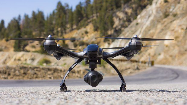
August 25, 2015 Small consumer drones have become the plague that Moses missed. So far this year, 650 drones have been spotted by airline pilots. That’s on pace to quadruple last year’s total, which is troubling because if a pilot can see your drone in the air, it’s close enough to worry about. In July, a wildfire in California consumed 20 vehicles on a highway north of Los Angeles when consumer drones interfered with firefighters for the fifth time that month. And testing jet engines against consumer drones has proved to be a challenge.

To answer this growing problem, Sen. Chuck Schumer last week proposed an amendment that would require consumer drone manufacturers to build software-controlled no-go zones—so-called geofences—into their aircraft. The idea is to let software keep them away from airliners, emergency crews, and the like. “This technology works and will effectively ‘fence off’ drones from sensitive areas like airports,” Schumer said in a press release. Two recent hacker demonstrations show that’s somewhat wishful thinking.

What is a geofence? It’s manufacturer-created software that prevents a drone from flying within certain GPS coordinates. Some drones already come with it; after an intoxicated General Services Administration employee crashed a friend’s DJI Phantom on the White House lawn in January, DJI issued a mandatory upgrade to its software: a geofence that prevents the popular toys from flying within 25 kilometers of the White House and other sensitive sites.

Schumer’s bill proceeds from the notion that such measures can keep drones out of trouble. But while geofences may help keep the average hobbyist away from the White House, hackers have already shown they can rip holes in them.
Earlier this month, researchers at the DEF CON hacker conference in Las Vegas, Nevada, demonstrated that the Phantom’s geofencing was easily manipulated in a variety of ways. Cybersecurity researcher Michael Robinson showed that the DJI Phantom III’s geofence draws upon a database that contained some 10,914 entries as of July 24. Each entry contains a country, city, a timestamp, and, more importantly, the latitude and the longitude of the no-fly zones, according to Robinson’s research.
“I very easily downloaded the database and started just changing entries, which I found very interesting,” he said.

Earlier this month, researchers at the DEF CON hacker conference in Las Vegas, Nevada, demonstrated that the Phantom’s geofencing was easily manipulated in a variety of ways. Cybersecurity researcher Michael Robinson showed that the DJI Phantom III’s geofence draws upon a database that contained some 10,914 entries as of July 24. Each entry contains a country, city, a time stamp, and, more importantly, the latitude and the longitude of the no-fly zones, according to Robinson’s research.

“I very easily downloaded the database and started just changing entries, which I found very interesting,” he said.

By tweaking the data, Robinson was able to make his Phantom ignore the manufacturer-set no-fly zones.

He said he also used a garage-made GPS spoofer to disrupt the geofence. He reported that the spoofer broke the drone’s return-home feature and compromised the video feed, which he described as suddenly “squirrely.”

Two other researchers, Lin Huang and Qing Yang, with the Internet security company Qihoo 360  out of China, also reported being able to disrupt a Phantom’s geofence by spoofing the drone’s GPS remotely, via software-defined radio. This is far more troubling because they didn’t need to have physical access to the machine, just be within range. But such results are harder to verify by independent American researchers because GPS spoofing is very, very illegal.

Perhaps more damning, the hackers demonstrated these tricks on products that the makers had actually undertaken some effort to secure. Phantoms use secure radio and GPS for guidance rather than the less secure WiFi or Telnet.

Defense One reached out to DJI Phantom for comment and has not heard back.

What does Robinson think of legislative efforts like Schumer’s? “With respect to policymakers, I would like to see policymakers get informed,” he said.

If the government can’t ward off drones using manufacturer-based geofences, what then? Don’t look to traditional military-grade air-defense systems, which are built to spot far larger and faster intruders. On April 15, a 61-year-old man named Doug Hughes took off from Gettysburg, Pennsylvania, in a homemade gyrocopter and flew through three no-fly zones to the steps of the U.S. Capitol. “Identifying low-altitude and slow-speed aerial vehicles from other objects is a technical and operational challenge,” Navy Adm. William Gortney, commander of U.S. Northern Command and North American Aerospace Defense Command, or NORAD, later told the House Committee on Oversight and Government Reform.

Still, the Federal Aviation Administration, the Homeland Security Department, and the military are giving it their best shot. On Sunday, NORAD staged an exercise near Washington, D.C., to test its ability to detect and intercept drones.

Last year, the military held the 10th edition of its Black Dart exercise, which focuses specifically on anti-drone defense. In recent Black Dart games, the military has focused more attention on so-called Group 1 drones: consumer quadrcopters and others under 20 pounds, like the one that crashed on the White House lawn, or the one that landed on the roof of the Japanese prime minister’s residence carrying a small amount of radioactive material back in April.


How do you differentiate between a 10-year-old kid who just doesn’t know any better and is flying something from a hobby shop and somebody who’s flying that identical something from a hobby shop but has nefarious intent?” said Air Force Maj. Scott Gregg. “You can’t tell that with a radar or an infrared sensor.”

Even if it’s possible to detect small drones like the DJI Phantom or the popular (and very hackable) Parrot BeBop as they move into sensitive areas, a bigger problem is taking them down in a way that doesn’t interfere with GPS or other electronic-signaling.

The defense industry wants in to the growing market of detecting and downing those diabolical drones. Scientific Research Corporation, or SRC, is marketing a set of systems they call “Counter UAS Technology.” Aimed at consumer-sized unmanned aerial vehicles, it uses radar and electromagnetic frequencies to down drones around a protected facility. “You’re going to be looking at acoustic sensors for very close. You’re going to be looking for electromagnetic warfare capabilities,” said Tom Wilson, SRC’s vice president of product accounts, who declined to get more specific about the system’s workings.

A company called Drone Shield also sells several acoustic sensors meant to detect drones near airports. But detecting and signal-jamming are very different, and the later presents serious legal hurdles. Drone Shield will sell you “a legal, safe, and reliable” drone net gun.

In the end, the best defense against small drones may lie somewhere between relying on manufacturer software updates (ineffective) and shooting them down (dangerous and uncouth). SRC’s Wilson said, “Our system is designed to operate without interfering with nonthreat systems.”

Failing that: Net gun, anyone?


http://cdn.defenseone.com/defenseone/interstitial.html?v=2.1.1&rf=http%3A%2F%2Fwww.defenseone.com%2Ftechnology%2F2015%2F08%2Fchuck-schumer-no-fly-zone-drones%2F119389%2F%3Foref%3Dd-river

Update: Intel invests $60 million in Chinese drone maker Yuneec

Yunnec

Intel has poured more than $60 million into Yuneec International Co., a Shanghai-based drone and aerospace company, as a broad range of technology companies investigate the possible commercial uses of unmanned aircraft.

Venture capitalists and companies are investing in drone technology on the expectation that unmanned aerial vehicles will prove beneficial for consumers and industrial customers. Amazon.com and Google are developing drones to deliver products to consumers. Yuneec’s Chinese rival SZ DJI Technology Co. raised $75 million from Accel Partners in May.


“At Intel we believe in a smart and connected world. And one of the best ways to bring that smart and connected world to everyone and everywhere has been drones,” Intel Chief Executive Officer Brian Krzanich said in a video announcing the investment by Intel Capital. “We’ve got drones on our road map that are going to truly change the world and revolutionize the drone industry.”Intel and Yuneec will work on developing future products, the companies said Wednesday. Yuneec makes drones for consumers and industrial users, as well as manned electric aircraft. Intel declined to provide further details on the collaboration. The Santa Clara, California-based semiconductor company has also invested in drone companies Airware and PrecisionHawk.

The Yuneec relationship fits with Intel’s strategy to make investments in companies developing products with the potential to expand the market for semiconductors, as the company searches for new devices for chips. Intel’s drone funding is similar to its investments in next-generation data center software companies such as Mirantis and Cloudera.

– Bloomberg News

http://www.oregonlive.com/silicon-forest/index.ssf/2015/08/intel_invests_60_million_in_ch.html

Sony’s quadcopter takes smartphone tech to the skies


Aerosense droneAerosense drone

A drone developed by Sony’s unmanned aerial vehicle venture Aerosense is seen in a promo image. The startup wil target enterprise users in everything from farming to construction from 2016. Credit: Aerosense
Equipped with a high-speed data transfer module, the quadcopter uses Sony’s lens-style camera to image construction sites and farms.

By Tim Hornyak

IDG News Service | Aug 24, 2015

Sony is gunning for a slice of the growing drone market, showing off newly developed unmanned aerial vehicles (UAVs) from its just-launched drone venture, Aerosense.

In addition to the vertical takeoff and landing (VTOL) craft hinted at last month, Aerosense on Monday exhibited a quadcopter that makes use of Sony’s lens-type camera, the QX30.

The camera, which resembles a lens for a digital single-lens reflex (DSLR) camera and can link to smartphones, is attached to the belly of the quadcopter, where it can take high-resolution images.

Designed for use in urban areas such as construction zones, the AS-MC01-P quadcopter weighs about 3 kilograms (6.6 pounds) and can fly for about 15 to 20 minutes on a battery charge.

It can operate autonomously, flying within a preset zone, and is equipped with GPS, Wi-Fi and an inertial navigation system. It also has a high-speed data transfer module that uses Sony’s TransferJet technology.

In a presentation in Tokyo, Aerosense showed how photography from the camera can be turned into 3D imagery, showing, for instance, the volumes of piles of gravel at a construction site.

The venture’s other craft, the AS-DT01-E winged VTOL drone, has a rotor system that allows it to fly like a helicopter or a plane. The advantage of the winged format is that it can fly at much higher speeds than most non-military drones — up to 170 kilometers per hour (106 miles/hour) compared to high-speed quadcopters that fly at 75 kph (47 mph).

Weighing 7kg (15 pounds), it can carry a 3kg payload (6.6 pounds) and operate for at least two hours on a battery charge.

Aerosense will target enterprise customers when it begins to offer drones for monitoring, surveying and inspection next year.

Potential applications include photographing agricultural land, mining sites and mountainous areas to check for damage after a storm.

Sony wants to use its smartphone technologies such as cameras and networking know-how to give Aerosense an edge. Sony Mobile Communications owns just over 50% of the venture, with the rest in the hands of Tokyo robotics firm ZMP, which set up a robot taxi company earlier this year along with mobile gaming giant DeNA.

Sony also has robotics resources that it is putting into the drone business. Aerosense’s CTO is Kotaro Sabe, who worked on the electronics maker’s Aibo robot dog and Qrio humanoid robot, both of which were shelved when Sony shut down its entertainment robot business about 10 years ago.

Sony’s Xperia smartphones have been struggling in Japan and overseas against the more popular Apple iPhone as well as Android rivals.

“It’s possible that future growth in smartphones could be limited, so we have to engage and invest in new business opportunities,” said Hiroki Totoki, head of Sony Mobile Communications.


http://www.computerworld.com/article/2975016/emerging-technology/sonys-quadcopter-takes-its-smartphone-tech-to-the-skies.html

Researchers envisage swarms of tiny drones for dangerous rescue missions

zhangpie

By 

Researchers at Carnegie Mellon University are working on a new generation of disaster drones that can be deployed in swarms into buildings to give first responders a look inside, mapping out the interior as they go.

The drones could be valuable in situations such as those faced recently after massive explosions ripped through a port in Tianjin, China, or in the aftermath of something smaller like a house fire.

“These places are very dangerous for rescuers to go, so we don’t want to just blindly send people inside,” said Pei Zhang, an associate research professor at CMU’s campus inside the NASA Ames Research Park in Moffett Field, California, where the research is taking place.

“Instead, we want to get these things in before people go in and determine if there are people that need help,” he said, gesturing to several drones on the table in front of him.

Zhang envisages using a larger drone, which he likens to a mothership, to carry multiple smaller drones into whatever environment is being explored. The smaller drones would deploy from the large drone and begin their work.

The larger drone, he reasons, has a longer range and can better handle wind and other effects of the environment. But it may be too large to send inside somewhere like a building that’s been compromised by an earthquake.

So the smaller drones, some of which can easily fit in the palm of a hand, would fly inside to do their work.

http://www.cio.com/article/2975766/researchers-eye-sending-swarms-of-rescue-drones-into-dangerous-places.html

Man Indicted For Shotgun Blasts At Hovering Drone

droneview465

AUGUST 25–A grand jury today indicted a New Jersey man on two felony charges for allegedly firing a shotgun at a hobbyist’s drone as it hovered near his residence last year.

Russell Percenti, 33, is facing criminal mischief and possession of a firearm for an unlawful purpose charges. The latter count carries a maximum of ten years in prison, while Percenti could face up to 18 months on the lesser felony rap.

Percenti, pictured at right, was arrested last September after Leonard Helbig reported that someone “shot his drone out of the air with a shotgun while he was taking pictures of a friend’s property that is under construction.”

A subsequent police investigation determined that Percenti, a restaurant employee, shot at the drone while it flew near his family’s residence in Cape May County at New Jersey’s southern tip.

As seen in the above photo  shot by Helbig’s drone, his friend’s property abuts the Percenti residence, which has an above-ground pool and a rear deck. It is unclear whether Percenti is the individual seen standing on the deck in the below drone photo

Helbig told TSG that the $1300 drone was about 100 feet above the ground when it was fired upon. Helbig, who operates Cape May Miniature Golf, estimated that five shots were fired at the drone, which he said was “destroyed” by the shotgun blasts.

http://www.thesmokinggun.com/documents/crime/new-jersey-drone-shooting-case-213450

New Boss on Construction Sites Is a Drone

Construction_drone

By Will Knight

For some construction workers, any thoughts of slacking off could soon seem rather quaint. The drones will almost certainly notice.

The workers building a lavish new downtown stadium for the Sacramento Kings in California are being monitored by aerial drones and software that can automatically flag slow progress.

Once per day, several drones automatically patrol the Sacramento work site, collecting video footage. That footage is then converted into a three-dimensional picture of the site, which is fed into software that compares it to computerized architectural plans as well as a the construction work plan showing when each element should be finished. The software can show managers how the project is progressing, and can automatically highlight parts that may be falling behind schedule.

“We highlight at-risk locations on a site, where the probability of having an issue is really high,” says Mani Golparvar-Fard, an assistant professor in the department of civil engineering at the University of Illinois, who developed the software with several colleagues. It can show, for example, that a particular structural element is behind schedule, perhaps because materials have not yet arrived. “We can understand why deviations are happening, and we can see where efficiency improvements are made,” Golparvar-Fard says.

The project highlights the way new technologies allow manual work to be monitored and scrutinized, and it comes as productivity in other areas of work, including many white collar jobs, is being tracked more closely using desktop and smartphone software.

http://www.technologyreview.com/news/540836/new-boss-on-construction-sites-is-a-drone/


Guarding Machu Picchu


How Peru is using drones to protect its archaeological treasures.

Machu Picchu, Peru, April 9, 2015.
Members of Peru’s Ministry of Culture drone team watch a DJI S1000 octocopter in flight at the ruins of Pisaq in the Sacred Valley in April 2015.

Photo by Faine Greenwood

150819_FT_droneBugpng

The eight-armed drone proceeds along the busy tourist road that leads up to the world-famous Machu Picchu archaeological site in Peru, floating just above the tropical forest that lines each side of the roadway. It’s piloted by Peruvian Ministry of Culture drone expert Aldo Watanave, who watches the device intently, his eyes occasionally darting to the little video screen that I’ve agreed to hold for him.

Another colleague is in control of the camera mounted to the drone’s underside, and he uses a remote control to snap a photo whenever Watanave tells him to. Just up the trail, a middle-aged French tourist with a walking stick comes into view, and he’s not happy to see the drone: He begins swearing profusely, as if we have personally violated him. “From the Ministry of Culture!” I shout back, attempting to gauge how crazy he is.

Drone archaeology is not without its occupational hazards, but for Watanave and his colleagues, the risks are more than worth it. With their drone mapping work, they’re demonstrating to archeologists and museums around the world how they can use aerial imagery to create inexpensive maps and 3-D models of humanity’s collective cultural heritage—virtual representations that may define the museums of the not-so-distant future.

Founded in 2013 by Luis Jaime Castillo Butters, the former deputy minister of cultural heritage and cultural industries, Peru’s drone archaeology team has quickly become one of the most active in the world, working to accurately survey and preserve the South American nation’s thousands of valuable archaeological sites. At the beginning, team members had no special engineering expertise or any prior experience with unmanned aerial vehicles, or UAVs. But in just two years, they have become an authority on this specific area of drone mapping, with archaeologists and drone pilots from around the world now reaching out to them for advice. “Anybody can do the work we do. Anybody can work with the drones, anybody can work with the software, anybody can produce the stuff we are producing,” Castillo explains. “We are simply doing it on a scale that is actually having a real impact on cultural patrimony.”

Since the program began, the Ministry of Culture’s drone team has mapped more than 600 sites, allowing it to create standardized records of archaeological data at a much faster pace than was possible in the days of ground-based surveying. The group has developed a relatively standardized process for its archaeological missions, primarily using Chinese drone maker DJI’s Spreading Wing S1000 “octocopters” for their mapping projects. The hefty drones are equipped with Sony NEX-7 mirrorless cameras and can stay in the air for roughly 15 minutes, but their battery life decreases when flying at a high altitude, as is often the case in Peru.

The drone team’s process begins with marking out at least three ground-control points in the area to be mapped, which can be identified from the sky with the assistance of a highly visible marker. Next, the archaeologists use a differential GPS unit to accurately survey (asses the location of) each point. The drone team assesses the weather—and also makes sure that any people on the ground are aware of what’s happening. When the all-clear is given, it’s time for liftoff.

Flying a drone in Machu Picchu, Peru, April 8, 2015.
Members of Peru’s Ministry of Culture drone team prepare a DJI S1000 octocopter for flight at the ruins of Pisaq in Peru’s Sacred Valley in April 2015.

Photo by Faine Greenwood

In simplest terms, aerial maps are made by combining hundreds of different photos—I wrote about this process in detail in New America’s new Drones and Aerial Observation primer. (New America is a partner with Slate and Arizona State in Future Tense.) To make sure the photos overlap enough, the drone has to fly in a specific pattern—it’s easy to think of this as the pattern a lawnmower makes as it traverses the lawn, with straight lines overlapping to ensure no spots are missed. Although many drone mappers program their devices to fly themselves in a predetermined pattern, Watanave is wary of automatic drone flight, thanks to the painful memory of a recent drone crash caused by a failed autopilot. Instead, the Peruvian pilots eyeball the pattern and fly it themselves at an altitude between 196 and 262 feet, shooting a photograph every 2 to 3 seconds.

Once shooting is over, it’s time for the archaeologists to use Agisoft Photoscan photogrammetry software to stitch the photographs together into a single image. The aerial maps and 3-D models that archaeologists use have to be geographically accurate—applicable to the real world and capable of being layered on top of pre-existing maps—so the software geometrically corrects (orthorectifies) the images so that they have a uniform scale.

The process may be relatively straightforward, but fieldwork has its own perils, from angry French tourists to technical error to simple poor luck. The $3,300 octocopters are relatively sturdy, but they’re definitely breakable. Not that this vulnerability stops the archaeologists: During my visit to Peru, I watched, impressed, as the team floated the drone (packed in a waterproof case) from the shore of an inflatable raft onto the rocky coast of an island somewhere off the coast near Lima. Two archaeologists walked the hefty box and its robotic cargo up the steep path to the top of the island they’d been sent to survey in punishing heat, as vultures watched their progress.

http://www.slate.com/articles/technology/future_tense/2015/08/how_peru_is_using_drones_to_protect_machu_picchu_and_other_archaeological.html