Capt. ‘Sully’ on drone rules: ‘We have a responsibility to do this right’

Take it from a guy who knows a thing or two about mid-air collisions, drones are a growing threat to civil aviation.

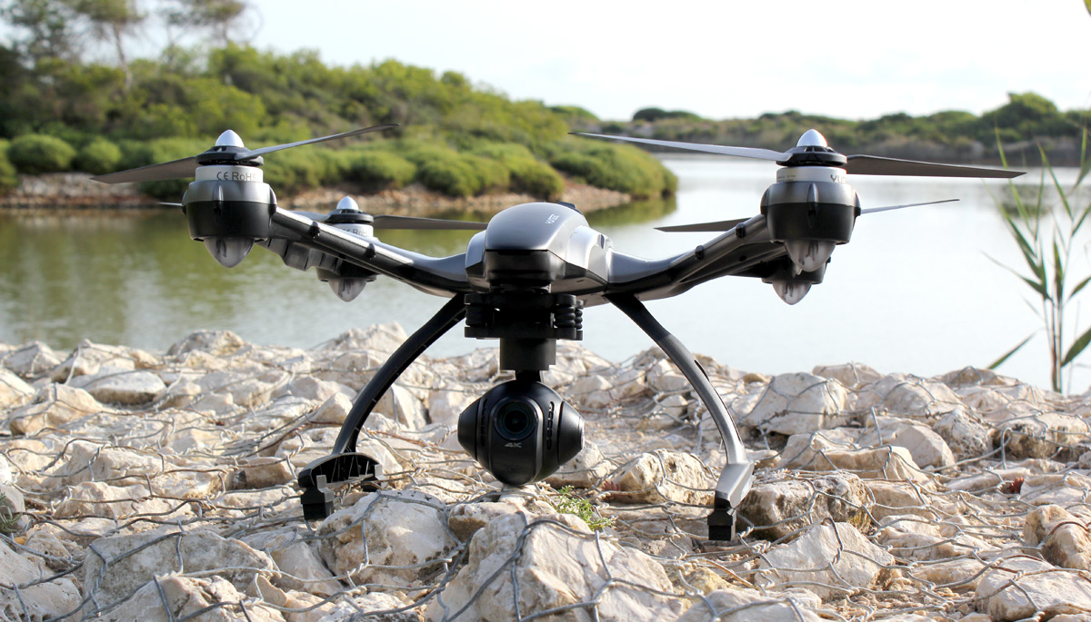
The use of drones—both recreationally and commercially—is on the rise, offering a boost to a booming drone industry expected to create billions of dollars worth of economic activity in the U.S. over the next decade. But significant uptick in close encounters between drones and manned aircraft—a quadrupling, in fact—is pushing many to call for increased regulation and better enforcement of the regulations that are in place.

One of the more prominent voices bringing attention to the heightened risk of a drone-on-aircraft collision is Capt. Chesley “Sully” Sullenberger. Sullenberger, most readers will recall, is the now-retired US Airways pilot that in 2009 managed to safely land his Airbus A320 passenger jet in the Hudson River, saving all 155 persons aboard.

On a recent appearance on Face the Nation, Sullenberger—now an aviation safety expert—told host John Dickerson in no uncertain terms just how bad a collision between a passenger aircraft and a drone could get. “We have seen what a six-pound or an eight- pound bird can do to bring down an airplane,” Sullenberger said. “Imagine what a device containing hard parts like batteries and motors can do that might weigh 25 or possibly up to 55 pounds to bring down an airplane. It is not a matter of if it will happen. It is a matter of when it will happen.”

Data on drone sightings by pilots released this week by the FAA would seem to support that assessment. In all of 2014 the FAA logged 238 drone sightings by manned aircraft. As of last week the FAA had tallied 650 drone sightings reported in 2015. That puts 2015 on pace to quadruple the number of drones spotted by pilots last year—an alarming trend given the potentially catastrophic consequences.

In a conversation with Fortune, Sullenberger emphasizes that he’s not making an alarmist prediction, nor does he want to see regulation stifle innovation in the emerging unmanned aircraft industry. What he does want to see is better risk management, better regulation of the recreational drone industry, and more enforcement of those regulations when drone operators do what he describes as “stupid, reckless, dangerous things.”

“It’s important to address this inherent tension between getting it fast and getting it right,” Sullenberger says. “How do we balance between undue delay and forcing people who fly to accept risk that they really shouldn’t have to accept? We do need to have a way for people to address business opportunities. We do need a way for people to use emerging technologies. But it should not be and need not be at the expense of having people who fly accept a level or risk that they should not have to accept. It is much more important to get it right than to get it fast.”

The ongoing debate over how exactly how to strike a balance between public safety and freedom to innovate escalated in June when Sen. Dianne Feinstein (D-Calif.) put forth a piece of draft legislation known as the Consumer Drone Safety Act. The proposed legislation would dictate when, where, and how recreational drones could be operated and require makers of drones to pre-install certain tamper-proof safety failsafes on recreational drones. “If we don’t act now, it’s only a matter of time before we have a tragedy on our hands,” Senator Feinstein said in a statement, echoing a growing refrain among advocates of increased drone regulation.

Some in the drone industry called the act legislative overkill, arguing that innovation in the industry comes from the kind of freedom to tinker that the Consumer Drone Safety Act would restrict. But Sullenberger says he supports the kinds of measures outlined in the proposed bill. “The version I saw when it was introduced, I support,” he says of the bill. “I think it goes a long way toward codifying certain requirements that could mitigate at least the risks that are known, the ones that we’ve identified. It goes a long way toward protecting the traveling public from the downside of this new technology as it’s being used currently.”

Currently, the technology is mostly being used recreationally in the United States. The FAA only recently handed out its 1,000th permit for commercial drone operation. Meanwhile, the Consumer Electronics Association estimates that 700,000 hobbyists will purchase drones this year, up 63% from 2014. These recreational users are largely unregulated and difficult to identify and prosecute when they do break the limited regulations that exist. That makes for an environment in which dangerous behavior can flourish, Sullenberger says.

In response to the uptick in drone sightings, two leading drone groups—the Association for Unmanned Vehicle Systems International and the Academy of Model Aeronautics—issued statements last week urging the FAA to step up enforcement of recreational drone rules. They also urged the agency to quickly finalize a set of small unmanned aircraft systems regulations that have been in the works for years.

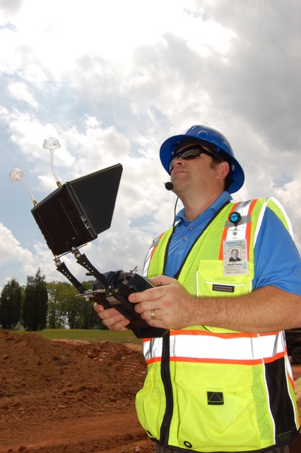
The finalizing of those rules—which would largely apply to commercial drone operators—will likely bring even more drones into the sky, but Sullenberger says he worries somewhat less about commercial operators. “In many cases you have licensed pilots who have the knowledge—they understand airspace requirements and the rules of flying,” he says. “I think that’s much less of a concern than the recreational side.”

Even so, he says, if we’re truly going to integrate drones—both commercial and recreational—into the national airspace alongside manned aircraft, even small drones are going to have to meet some of the same requirements as manned aircraft. Those include a means to electronically identify themselves to air traffic controllers and other aircraft and some way to see and avoid other objects in the sky. That’s going to require some leaps forward in technology and it’s going to take some time.

“Making safety a core business function is really what we’re working toward in aviation, and it’s an approach that’s paid dividends,” he says. “That’s the approach we must take with this issue as well. We have a responsibility to do this right.”

http://fortune.com/2015/08/17/captain-sully-drones/


More enforcement coming for careless drone operators, trainer says

Vancouver, BC, Canada

After a rogue drone grounded firefighting helicopters near Oliver for nearly five hours, the devices are again in the spotlight.

David Carlos owns Victoria Aerial Photos and Survey, a school that trains UAV pilots. He says commercial operators currently need licenses – but so far consumers don’t.

“But it’s coming. I really believe it’s going to come soon. Based on what we’re seeing happen. And, I think everybody … it should be like boating, recreational boating licenses. Even recreational people have to have a basic idea of what they’re doing.”

He says contrary to what some seem to think – the rules around flying them are very clear.

“And it says right there on the ‘don’t fly’ – it says ‘within restrcited airspace, including near or over military bases, prisons, and forest fires. Anywhere there’s a forest fire is restricted airspace, automatically.”

Carlos say Transport Canada does have clear rules about what’s allowed – but catching troublemakers can be tough.

He says incidents like today’s will likely lead to better enforcement.

http://www.cknw.com/2015/08/16/drone-school-owner-says-enforcement-coming-for-bad-operators/

DJI’s Phantom 3 has it’s biggest rival in YUNEEC’s 4K Typhoon Q500

We’d understand if you’re not familiar with Yuneec; we’ve only written about its products twice. However, it’s fairly well-known in the quadcopter world, and best described as a direct rival to DJI. When I reviewed DJI’s 4K Phantom 3 Professional drone ($1,259), a reader asked if we could compare it to Yuneec’s rival Typhoon Q500 model (around $1,100, but with a lower-res 1080p camera). Days later, Yuneec announced an updated Typhoon with 4K shooting for $1,299, making the comparison much easier. It only seemed fair to grant our reader’s wish, and check out what the new Typhoon had to offer.

The similarities between DJI’s and Yuneec’s consumer quadcopters are many. Both have 4K cameras with stabilizing gimbals. Both are “ready to fly,” which mostly means there’s no assembly required; just charge and go. Both are easy for beginners to control, and both offer first-person view (aka FPV), or the ability to see what the camera is seeing in the air in real time, usually via the transmitter/controller. There are other products that offer a similar feature set, but DJI and Yuneec have done a good job packaging them in ways that appeal to new flyers and hobbyists alike.

There are also some significant differences and on paper, at least, many of them are in Yuneec’s favor. Despite being slightly more expensive, the Typhoon offers better value. The $1,299 4K version is available with a carry case (you’ll need to buy one for your Phantom). It also comes with two batteries versus one on the Phantom. Then there’s the transmitter, which has a built-in touchscreen display. This is how you view what the Typhoon’s camera sees (you can also use it to access settings). In contrast, DJI users need a phone to do this, this approach works well, but is one more thing to bring along/charge. The last, and perhaps coolest extra with the Typhoon, is the Steadygrip, a hand-held mount for the 4K camera. Detach it from the drone, clip it to the accessory and you can film smooth video on the ground, too. DJI’s working on a similar product, but it’s not available yet, and won’t ever be in the box of the Phantom 3 (the camera is non-removable).

You’re also getting more flight features with the Typhoon. The ground station has GPS in it (actually, most quadcopters do, but not always the transmitter). This means the Typhoon has options like “follow me” and “watch me,” which Phantom 3 doesn’t have right now (but some features are coming eventually). So, the Yuneec is the one to get, right? Maybe. The real test is taking it up in the air and shooting some video. Which is, of course, what I did.

I’ll preface my impressions by stating that I learned to fly on a Phantom, and have flown one for many hours, so this is what I am used to. Yuneec made the Typhoon pretty easy to fly. I had a few minor wobbles the first time, but this might be because of my prior Phantom experience. One example is that, by default, the Typhoon won’t fly within 26 feet of you (or, really, the transmitter).

This caught me off guard when I first tried to land, as I’m used to bringing the Phantom in real close, and sometimes “catch landing” (getting it low enough to hold the landing gear, and make it think it’s on the ground). I had the Typhoon above water, and it wouldn’t come nearer. I had to walk backward far enough to be able to land it on solid ground, and not in an ideal spot (see the photo at the top of this article). The same problem can catch you out mid-flight, too. It’ll suddenly stop moving as it hits the exclusion zone around you. I get it; it’s a safety feature (and one you can turn off).

The Typhoon’s biggest problem in the air, I found, was that it’s not as responsive as the Phantom. DJI’s consumer product is quite a bit smaller, and responds quickly to any touch on the controls. You can throw it left to right quite sharply, and it’ll visibly pitch (but hold its position), and it manages to do so while keeping the camera steady — though if you really throw it, the landing gear/propellers can get in the shot. The Typhoon felt more sedate. Not sluggish, but less immediate. You can control its speed, but that doesn’t change the general responsiveness. Some might say this is a benefit, since I only once got propellers in the shot. But I do prefer the tighter feel of DJI’s setup.

What the Typhoon does have going for it is excellent battery life, so you get more time in the air. On average I got 20 minutes before it would start warning me to bring it home. The Phantom 3 starts complaining between 15 and 17 minutes, I’ve found. It might not seem like a big difference, but those extra few minutes feel like hours when you’re behind the sticks. One minor thing: I’ve never been a fan of how the Phantom 3 looks, but I like the Typhoon even less. As one colleague put it, it looks like it should fire Nerf bullets. It’s a little… on the boyish side. The Phantom 3 isn’t handsome, but smaller and more unthreatening.

Gallery | 10 Photos

Yuneec Typhoon Q500 4K sample shots

Most important for many people will be the quality of the camera. The quadcopter is going to be secondary for customers that are interested in the aerial video first. Here, I think DJI wins. The camera on the Typhoon is pretty decent, but it reacts to different light conditions with mixed success. In the sample video, you can see the difference with the direct sun in the opening clip (the second clip is just moments later, without the sun in shot), or spot the color/temperature of the ground change as I adjust the camera pitch between the 1:50 and 1:56 minute mark. On a positive note, there’s very little fish-eye curving going on, and the results are generally pleasing. But, between the two, the Phantom 3 Professional appears to have the edge.

With more time, I might get to love the Typhoon a bit more, who knows. Right now, though, I’m still leaning toward the Phantom 3. The Typhoon definitely offers more value, and the extra flight features will appeal to some people. But, if your priority is video and photos, or ease of flying, or both, the Phantom 3 steals it.

http://www.engadget.com/2015/08/16/yuneec-4k-typhoon-drone//


Regulation of UAV in Australia – a balancing act

uav

Earlier this month, Australian start-up Flirtey was involved in the first successful drone delivery to be legally conducted in the United States. This is the first step in what could be a revolution in the way medical and other supplies are provided in remote areas.

One of the key impediments to the use of drones in the United States has been its restrictive aviation laws (the recent successful trial in the United Stated required Federal Aviation Authority approval).

By comparison to the United States, Australia has less restrictive laws in relation to the flying of drones. The Civil Aviation Safety Authority (CASA) is in the process of reviewing and modernising the regulation of drones and expects to complete this by 2016. While the United States is looking to decrease the regulation of drones in order to stimulate technology development, there is speculation that Australia will introduce more stringent regulations in relation to drones.

Any new regulations will need to strike a balance between protecting the safety and privacy of individuals, without overly restricting the ability of Australian organisations to exploit this evolving technology and the commercial opportunities that go alongside it.

CURRENT REGULATIONS: Civil Aviation Safety Regulations 1998

CASA is the body responsible for regulating Unmanned Aerial Vehicles (UAV) in Australia. UAV are colloquially referred to as “drones”. Most UAVs are piloted by remote control and often mounted with cameras.

Under the Civil Aviation Safety Regulations 1998, UAV (weighing more than 100g and less than 100kg) cannot generally be flown:

  • higher than 400 feet;
  • within 10m horizontally and 30 feet vertically of a person (although there are exceptions to this prohibition for those involved in operating the UAV and others standing behind the UAV on take off);
  • over a large group of people at a height from which, if any of its components fail, it would not be able to clear the area;
  • over or near prohibited or restricted areas (such as an aerodromes or restricted military areas);
  • in conditions other than Visual Meteorological Conditions (i.e. bad weather);
  • in or into a cloud; or
  • at night.

It may be possible to use a UAV outside some of the above restrictions:

  • with the approval of CASA or another relevant authority (such as air traffic control); or
  • if the UAV is being operated within the sight of the UAV pilot.

There is also a general prohibition on flying a UAV in a manner which is hazardous to property, a person or another aircraft. The maximum penalty for contravening this provision is 50 penalty units (which currently amounts to $8,500).

Dropping off parcels or other items via a UAV is not prohibited, provided that nothing is dropped or discharged from a UAV in a way that creates a hazard to another aircraft, person or property.

In addition, companies that use UAVs must obtain an operator’s certificate from CASA and any individual that flies a UAV for commercial gain must have a controller’s certificate. There are currently 257 certified UAV operators in Australia, and with UAVs available for sale in Australian retail stores, this number is expected to increase exponentially over the coming years.

Can I fly over private land?

As UAVs are new technology, there is some uncertainty as to when the flying of a UAV over private property without permission will amount to a trespass to land.

A trespass to land is an interference with land owners’ rights. Land owners’ rights extend to the airspace over their land to a reasonable height.

There is no clear guidance on the height a UAV needs to be flown to avoid trespassing on private land. Based on past cases that have dealt with aerial photography from planes, scenic helicopter rides, and the height that bullets can be shot across land – as long as the UAVs are flown over land quickly and at a height that does not detract from the land owner’s use and enjoyment of their property, there is no trespass to land.

Will the Privacy Act apply to video footage taken by a drone?

The Privacy Act 1988 (Cth) only applies to Commonwealth agencies and organisations with an annual turnover of more than $3 million (with certain exceptions). Private UAV pilots and small companies (such as technology start-ups) would generally not be subject to the Privacy Act.

If an organisation is caught by the Privacy Act and it uses UAVs:

  • The video footage taken by the UAVs they use or control could potentially be considered “personal information” if someone can be identified, or reasonably identified, in the video footage.
  • Whether someone can be reasonably identified will depend on the circumstances. For example, footage taken by a UAV of a well known celebrity, or an individual that is well known to the organisation, would likely amount to the collection of personal information. The organisation would need to comply with the Australian Privacy Principles (APPs) in the Privacy Act regarding the collection and use of such personal information. Under APP 5, an organisation must take such steps as are reasonable in the circumstances to provide a privacy collection notice (this can be at the time of collection or, if that is not practicable, as soon as practicable after the collection). While there is a strong argument that it would not be reasonable or practicable to provide such collection notices in many instances where UAV video footage is taken of identified individuals, whether a collection notice needs to be issued will ultimately depend on the particular circumstances of each case.

CONCERNS WITH THE EXISTING LAW – A QUESTION OF PERSPECTIVE

An individual’s perspective

Currently in Australia, UAVs are primarily regulated from a safety perspective. There are no specific regulations which protect the privacy of individuals in connection with the use of UAVs other than those in the Privacy Act (which, as shown above, do not apply to individual private operators).

Unfortunately, except in exceptional circumstances, there is little that you can do to prevent a nosey neighbour from taking video footage of your backyard using a UAV. As a result, the government is under increasing pressure to enact legislation that prevents UAVs filming individuals on private property without their consent.

In the Australian Law Reform Commission’s report ‘Serious Invasions of Privacy in the Digital Era’ tabled in September 2014, it recommended the enactment of a new statutory cause of action for serious invasions of privacy. Such a new action could potentially apply to private UAV pilots if they recorded an individual in circumstances where the individual would have a reasonable expectation of privacy. This may assist individuals to take action against neighbours and unscrupulous operators who use UAVs in a manner that invades their privacy.

The commercial perspective

While introducing a new statutory cause of action would offer more protection to individuals, it would likely increase the administrative burden of operators in the emerging UAV industry. For example, real estate photography organisations may be required to obtain consent from numerous homeowners before they take sweeping footage of a property’s surrounds from a UAV which would be impractical.

As we have seen, the existing laws already create a number of issues for operators of UAVs:

  • there is no clear guidance on the height a UAV needs to be flown in order to avoid trespassing on private property; and
  • if an operator is subject to the Privacy Act, it is not always clear if and when such an organisation needs to provide a privacy collection statement to “identifiable” individuals, and otherwise comply with the privacy laws, regarding any video footage taken by a UAV.

To facilitate the use and investment in UAVs and new innovative delivery services, any new regulations should clarify the height at which UAVs can fly without risk of liability for trespass to private property and clarify that an organisation is not required to comply with the Privacy Act in relation to footage taken by UAVs. In addition, any new statutory cause of action for invasions of privacy should be carefully drafted to ensure it does not extend to incidental and non-intrusive drone video footage.

WHERE TO FROM HERE

While CASA is in the process of amending the regulation of UAVs and expects to complete this by 2016, it has indicated that the privacy issues associated with UAVs are beyond its remit. The new regulations will need to carefully balance the interests of ensuring its citizens are appropriately protected whist minimising “red tape” in order to encourage growth and investment in this emerging sector.
This article was provided courtesy of By Matthew Craven (Special Counsel) & Claire Harris (Graduate Lawyer), of Corrs Chambers Westgarth lawyers.

http://www.spatialsource.com.au/2015/08/17/regulation-of-uav-in-australia-a-balancing-act/

Iowa State Extension field day to include information on drones

ISU researchers look over a drone.

An Iowa State University field day at the end of this month will feature a discussion on using Unmanned Aerial Vehicles on the farm. Ryan Bergman in the ISU’s Department of Ag and Biosystems Engineering is the organizer of the field day.

He says the UAV’s can be another tool used by growers. “There’s still a lot of unknowns in the area of UAV’s and aerial imagery specifically in the agriculture sector,” Bergman says. “And so a lot of what we are going to be showing at the field day, and a lot of the research that my team is doing here at Iowa State is focused around how do we utilize this imagery to help us make better management decisions for our operations and allow us to cost-effectively utilities this new tool.”

Bergman says the images from the drones can turn up many issues in the fields. “We can tell a lot of differences across the field, compaction issues show up relatively well in a lot of aerial images, drainage issues show up extremely well. Those are some of the early things that we are seeing, but we think there a lot of other uses that we can employ aerial imagery in down the road,” according toe Bergman.

While the drones are a new tool to get information on your crops, Bergman says its just one piece of the puzzle. “Whatever you are see in the imagery — at this point we aren’t recommending that you can make a management decision of that really — unless you can verify it on the ground what’s happening. It’s completely visual, so there can be a lot of times be other factors that are affecting that image and it may not be due to the crop,” Bergman says. He says growers will still have to do some leg work once they find potential issues in the images from a drone.

“That’s one thing that we’ve really been stressing — if you see something in the image that should tell you where in the field you should look — and then you go out there and look. And based on what you are seeing in the field based on the image, then you can make a decision off of that,” Bergman explains. An attorney with the Center for Agricultural Law and Taxation at Iowa State will also be on hand for a discussion on the legal issues surrounding UAV’s.

“That’s still kind of a gray area right now, and so that’s why we have her coming to kind of talk through some of those issues with the growers,” Bergman says. The field day is August 27th at the ISU research farm located near Boone on Highway 30. The field day starts at 8:30 and is free to the public.

http://www.radioiowa.com/2015/08/15/iowa-state-extension-field-day-to-include-information-on-drones/

How are environmentalists putting drones to use to help further their causes?

L_111914-research-droneDear EarthTalk: How are environmentalists putting drones to use to help further their causes?
– Joe Martin, Baltimore, MD

Conservationists are utilizing drone or “unmanned aerial systems” (UAS) technology to gather highly detailed imagery and other environmental data that is traditionally challenging to obtain. Wildlife biologist John Takekawa and his team at the U.S. Geological Survey’s Western Ecological Research Center (WERC), for example, are using drones to obtain aerial images of San Francisco Bay marshlands.

“It’s very hard to get some of the data sets in some of these areas that are remote or hard to reach in the marshes,” Takekawa explains. “If you have something that can fly over and get sensors that can report back to your computer, that’s what we’re looking for in exploring these types of technologies.”

Dr. Amy Woodget, a post-doctoral researcher at the University of Worcester in the UK, uses her small Draganflyer X6 UAS to collect high-resolution imagery of river channels. The images map the physical conditions within the rivers, including the channel topography, water depth and surface flow patterns, data all crucial for gauging river health and habitat conditions essential to the survival of local wildlife.

“The results obtained using UAS technologies provide unprecedented levels of detail concerning these physical river habitat parameters, with high levels of accuracy and precision,” Woodget says.

Drones are also helping preserve the Peruvian Amazon forest, where illegal gold mining and logging has cleared mahogany, Spanish cedar and other old-growth trees. Carlos Castaneda, coordinator of the Amazon Basin Conservation Association’s Los Amigos Conservation Concession, monitors the 550-square-mile Los Amigos reserve in southeastern Peru, home to a large diversity of plant and animal species, including palm swamps, bamboo thickets, giant otters, harpy eagles, spider monkeys and jaguars. Small drones weighing less than five pounds enable detection of any deforestation within the area.

Considering that more and more drones are being launched for conservation research, Linda Rothschild, an evolutionary biologist at NASA’s Ames Research Center, was concerned when she found out that UAVs sometimes get lost in coral reefs or other sensitive habitats. “As I started to hear about this, I thought, ‘Well, wouldn’t it be useful if the UAV was biodegradable, so if it crashed somewhere that was sensitive, it wouldn’t matter if it dissolved,’” Rothschild says.

So Rothschild created a biodegradable drone with a team of students in the 2014 International Genetically Engineered Machine (iGEM) competition. The team’s prototype took its first short flight in November 2014 at the iGEM competition in Boston. The drone, which resembles a cardboard cup holder, is made primarily of mycelium grown by New York-based Ecovative Design. The team grew cellulose leather-like sheets to coat the mycelium body and then covered the sheets with proteins sourced from the saliva of paper wasps—a water resistant material that the insects use to cover their nests. The biodegradable drone body is certainly a step forward, though the drone still uses a standard battery, motor and propellers.

Rothschild’s dream is to make a UAV where every part is made with something biodegradable, but for now, she says, “realistically, this is going to be much more of a hybrid vehicle.”


http://augustafreepress.com/how-are-environmentalists-putting-drones-to-use-to-help-further-their-causes/

Amazon’s (Not-so) Secret Drone Test Site

by: Gary Mortimer • 16 August 2015

A rumour and purple tent was all it took for GeekWire’s Jacob Dement to claim a secret Amazon drone testing site.

There I was, air conditioner blasting in my Car2Go as I sat in front of a red gate on a gravel road in rural Snoqualmie, Wash. Multiple locals told me this was what I had come looking for: the entrance to Amazon’s secret drone testing site.

I wasn’t lucky enough to show up on a day when Amazon’s prototype delivery drone was being tested. But then I pulled up Google Maps to try to get a sense of where exactly I was.

And that’s when I saw it.

This satellite image, taken on a previous day, shows activity in the area beyond the gate. You can see a couple dark objects on the ground at either end of the image, what looks like a purple tent, a white van and some other vehicles — exactly where people in the area told me they’ve seen Amazon’s team set up.

Does it really matter if some Amazon employees are off multirotor flying somewhere?

We know they are!

Lets find some facts for Jacob, all thanks to published data from the FAA.

Long time sUAS News readers will be aware of our Drone Spotters collection of drone tail numbers from around the world, set up to monitor who was selling what to where. I notice Amazon registered its third official drone. N394PA appeared on the register just last Thursday.

We can learn some stuff from their naming, its a mark 24, so I think it’s fair to assume the 24th type of prototype and its serial number 14 so there are at least 14 mark 24’s out in the wild.

It joins N391PA and N392PA, serial numbers 6 and 8 respectively.

N393PA is not going to happen as it’s already allocated to an autogyro.

The questions I would ask is have they distributed other airframes to test simultaneously around the world and are Amazon just creating marketing footage in the USA?

Flying around a bit at the end of a track is hardly testing detect sense and avoid. Its not probing the platforms sensitivity to EMF. Its not testing a whole host of things.

Jacob, please do me a favour pop back and see if you can find a second site. One about 5km away. One that Amazon might be flying test deliveries to. That would be the sort of thing I would be testing to a track in the middle of nowhere.

Jacob also head off to Walmart and buy a scanner Unidenscanner

Then listen out on the local air traffic frequencies just in case the Amazon guys are doing the right thing and calling their position for VFR traffic in the local area.

It might also be worth dropping into Fall City Airport and finding out if any Amazon execs have flown in. They probably have a working relationship with the test team.

I would do it myself but its Sunday morning in South Africa and time to go out for a family breakfast. (some time passes) After breakfast I found the spot, skip to the bottom.

Here’s what Amazons Paul Misener, Vice President, Global Public Policy had to say last year in their FAA 333 exemption.

Our R&D operations will provide for a level of safety that far exceeds the level of safety required by FAA for hobbyists and manufacturers of model aircraft. The following operating procedures will apply during the R&D testing conducted under this exemption request:

  1. The sUAS will (i) have a maximum weight of less than 55 pounds; (ii) be rotor‐ powered via a battery source; and (iii) be U.S.‐registered and display marks in accordance with 14 C.F.R. Part 45, Subpart C.5
  2. Our sUAS R&D testing under this exemption will be conducted (i) within the visual line of sight of the operator and/or one or more observers; (ii) at less than 400 feet AGL; and (iii) within Class G airspace.
  3. The operations will be conducted in a confined area over isolated Amazon private property located a sufficient distance away from (i) any airport, heliport, seaplane base, spaceport or other location with aviation activities; (ii) any densely populated areas; and (iii) any military or U.S. government installations or airfields.6
  4. All operations will remain within the lateral and vertical boundaries of the operating area, taking into account all factors, including wind, gross weight and glide distances, that may affect the capability of the sUAS to remain within the airspace boundary; moreover, the integrity of the operating area will be reinforced by geo‐fencing,7 including the ceiling height of no more than 400 feet AGL.
  5. Our sUAS R&D testing under this exemption will be conducted (i) under the supervision of a designated pilot in command (PIC) who has final responsibility for the operation in accordance with 14 C.F.R. § 91.3 and either (A) holds a current FAA private pilot certificate issued under 14 C.F.R. Part 61, Subpart E, a higher FAA pilot certification, or a FAA‐recognized equivalent8 or (B) has completed FAA private pilot ground instruction and passed the FAA private pilot written examination or FAA‐recognized equivalent; and (ii) using only operators that have completed training on the normal, abnormal, and emergency procedures in specific details and demonstrated proficiency with the sUAS being operated.
  6. No operator or observer will engage in, nor may an operator or observer permit, any activity during a critical phase of flight which could distract any operator or observer from the performance of his/her duties or interfere in any way with the proper conduct of his/her duties.
  7. Operators will maintain the sUAS system in a condition for safe operation, and conduct a pre‐flight inspection prior to each flight so as to ensure that the sUAS, control station, data link equipment, payload, and support equipment are in a condition for safe operation and in a configuration appropriate for the purpose of the intended flight.
  8. The operators and observers will maintain two‐way communications with each other during all operations; if unable to maintain two‐way communications, or if any condition occurs that may otherwise cause the operation to be unsafe, the operator will immediately conclude the operation.
  9. Each sUAS will safely stop operating and return automatically to a specific location on Amazon’s private property if the communications link is lost.
  10. For each sUAS, the observer will have the ability to press a physical button, that will be within his/her reach at all times, that reduces power to the vehicle so as to force a controlled landing; both the hardware and communication for this safety system will be physically separate from the sUAS flight control systems.
  11. Testing operations will be conducted on private property, and only Amazon employees, contract personnel, and invitees will be invited to the operations area; security measures will be put in place to deter unauthorized access.

A gentle VR flight and I found where it is

amazonssecretsite

amazonssecretsite2

I guess distance is a relative, living as I do in Africa 45 minutes very often is the minimum you have to travel for more life. I have lived in places where an aeroplane was the only way to the shops.

With that in mind, this line…

So I grabbed a Car2Go in Seattle and made the 45 minute drive out into the middle of nowhere. It’s the kind of place where “No Trespassing” signs outnumber doorbells and people don’t seem fond of strangers wandering on to their front porches.

Then checking, its 6 minutes to the nearest African sounding joint, Sahara Pizza (tenuous I know) Raised a smile here. Also amusing the railway stations of startup and goldbar to the right of the title map. That’s why I made it so wide.


http://www.suasnews.com/2015/08/37836/amazons-secret-drone-test-site/

FAA gives ND expanded UAS flight testing capabilities

  • The FAA authorized North Dakota’s Northern Plains UAS Test Site for night operations and to allow UAV flights statewide above the 200-foot ceiling set for the other five test sites.
    PHOTO: UNIVERSITY OF NORTH DAKOTA

Unmanned aerial systems (UAS) development in North Dakota received a boost from the U.S. Federal Aviation Administration (FAA) this week while also marking the first flight of an unmanned aerial vehicle (UAV) from a general aviation airport.

The FAA gave the Northern Plains UAS Test Site approval to expand operations and night flight testing capabilities throughout the state. The University of North Dakota (UND) last week noted a flight test of the Northrup Grumman SandShark UAV conducted from the Lakota, North Dakota, public airport in conjunction with the Northern Plains UAS Test Site.

The FAA said its expanded authorization for the state was granted under the agency’s Certification of Authorization (COA) process, allowing industry more efficient access to airspace for collaborative research. The FAA said it approved the COA application based on the maturity and the demonstrated safety and operational processes used by the Northern Plains UAS Test Site.

“The addition of night flying opens up the opportunities for industry partners to test sensor payloads in all lighting conditions,” said Robert Becklund, test site executive director.

The Northern Plains UAS Test Site also received a COA that makes the entire state available for testing at altitudes higher than the 200-foot blanket COA issued to five other FAA approved sites. North Dakota is the first test site to be entirely covered by a COA that includes airspace above 200 feet for UAS testing.

The SandShark flight from the Lakota airport was part of a test project jointly funded by Rockwell Collins and the North Dakota Department of Commerce, according to Doug Olsen, project manager and a member of the UND UAS Center team. Rockwell Collins—located in Cedar Rapids, Iowa—is a manufacturer of avionics for manned aircraft and is developing UAV applications of its technologies.

“This was a milestone flight because right now there are no regulations allowing routine UAS flights at U.S. public airports,” said Al Palmer, director of the UND UAS Center of Excellence. “We are working closely with the FAA to ensure we conduct safe operations under our COA at the airport.”

Olson said, “Rockwell chose UND to test this new technology because of our UAS and test site capabilities. While this first flight was for crew currency and aircraft checks, the nature of the project—our objective—is to eventually fly with new Rockwell Collins radio technology to test how well it works, controlling UAS beyond line of sight.”

UND received the SandShark as the result of a cooperative agreement with Northrop Grumman Corp. to provide UAS pilot training to domestic and global customers. The agreement also encourages development of new technologies for UAS using the SandShark.

http://www.uasmagazine.com/articles/1203/faa-gives-nd-expanded-uas-flight-testing-capabilities

Take flight with drone workshops

 LINDA WHITE

Special to Postmedia Network

durham-drones

Retail giant Amazon’s much-publicized plans to launch a drone-based delivery service is still years away but unmanned aerial vehicles (UAVs) are already in our skies and their use goes well beyond the military.

They’re being used to take incredible aerial photography, assist search-and-rescue crews, monitor and inspect everything from mines and crops to wildlife population, and so much more.

Consumers of all stripes are embracing the technology but without training, permits and proper insurance, they’re putting themselves at unnecessary risk, says Marcus Dickinson, CEO at X4 Drones and a UAV instructor who will be offering introductory and advanced workshops at Durham College this fall.

“People rush out there and buy the biggest, most expensive, shiniest drone they can get,” Dickinson says. “The retailer is under no obligation to make sure their customer is not only educated but insured to fly their UAV and hands them these things that are literally flying chainsaws.”

Too often, drone users rely solely on their unit’s autonomous system and don’t understand how factors like solar flare activity can affect a drone’s GPS. “They either lose their unit, crash their unit or hurt somebody or themselves with their unit,” he says.

Dickinson encourages anyone interested in flying a drone to learn how to manually pilot it first. “Master it,” he says. “Then and only then should you be working with a more complex unit.”

Here’s a look at the workshops he will be offering at Durham College:

Drones – Intro to Flight: The hands-on workshop covers the basics of drone operation and principles of UAV flight, including axis of flight control, wind turbulence and the basics of radio frequencies and transmissions.

“You learn how to fly with a qualified instructor who will offer tips and help you get comfortable with the units,” says Dickinson. “These units have no autonomous capabilities — it’s all manual flight.”

UAV Operator Training: Learn about GPS, compass and barometer technology; make use of semi- and full- autonomous unit functionality; and conduct pre- and post-flight safety checklists. Learn about Transport Canada regulations, insurance requirements, privacy law and municipal bylaws to start your own aerial photography and videography business.

“You’re legally allowed to use drones for wedding photography and real estate but you have to be an incorporated business in order to get drone insurance and you cannot apply for a special flight operation certificate from Transport Canada if you don’t have that insurance,” Dickinson says.

The interest in training continues to grow. “We have found a huge market for educating consumers,” he says. “We also do professional services … and are training skilled workforces on how to safely use these things for higher-risk applications.”

Durham College workshops

Drones – Into to Flight: This three-hour hands-on workshop will be held Sept. 19, 2015. Participants must purchase a drone (approximate cost $70), payable to the instructor at the start of class.

Unmanned Aerial Vehicle Operator Training: This three-hour workshop will be held Oct. 19, 2015. A GPS-enabled drone is required as well as safety boots, gloves and glasses. The introduction workshop is a prerequisite.

Visit durhamcollege.ca/coned to learn more.

linda.white@rogers.com

http://www.torontosun.com/2015/08/13/take-flight-with-drone-workshops

Tired of a bad rap (and I’m not talking run DMC)

IMG_9123

It’s a great time to be in the UAS industry. New rigs and accessories are being revealed weekly. If you are reading this article, there’s a good chance you are serious about how you operate whether you are a commercially licensed pilot or a photographer transplant that had to add a UAS to stay ahead of your competition. In either case, to further this industry we must utilize SOP’s (standard operating procedures) and FOM’s (flight operations manuals). Let me explain why.

After 15 years as an ATP licensed pilot and flying airplanes for 26 years, I have checklists and standard operating procedures deeply engrained in my cerebellum. I have applied these to other areas of my life due to their efficiency. For now, lets just look at transportation. Imagine your morning commute, you find the interstate filled with big rigs without brakes doing 180MPH. Sound scary? Well, think about some of the drivers having learner permits, and some who have more experience, all mixed together out there. Wouldn’t you like a little more organization out there? Someone controlling a bit of that? That’s just what our Air Traffic Control system does.

ATC handles around 28,537 commercial flights per day. How do they manage to all operate safely? An airline pilot sometimes meets his copilot minutes before they take a metal tube 36,000 ft in the air at 593.741miles an hour. Standard Operating Procedures is a giant part of those 28,537 successful flights. Because of the SOP’s, both pilots could literally not talk (except for reading the checklist) the entire flight and know what and when the other pilot was going to do the ENTIRE flight.

As I said in the beginning, if you are reading this, you are trying to operate professionally. In order for the general public, clients, and government entities to have confidence in professional UAS operators, we should have these things in place. Not only do they exponentially increase safety, and make things more efficient, but they also show professionalism. Do you currently have a procedure for camera man loss of monitor, bird strike, erratic control issues, securing launch points? Do you operate the same way every time? Do you and your cameraman use headsets? Does your VO know anything about UAS operation? Does your video editor know the order of sent videos? Having SOP’s in place creates efficiency and adds safety to your operations. After all, time is money and we all know what a lack of safety can do to the wallet. Not only that, but this industry certainly does not need anymore help with bad press!

When we, a group of professional commercial pilots, decided to create this company it was natural for us to build the company with the same parameters as the aviation environment we were all familiar with. For example: NO equipment is taken out until a walk around is completed. We mark our launch area with a launch pad and secure our entire flight area so that everyone around is familiar and comfortable with our operation. Our job spec sheet is completed and put on our launch pad before flight so that it gets recorded as we check our controls. So just like any professional aviation operation, anyone of our operators can fly or camera any one of our rigs.

The technology available to us makes creating a safe operation even easier. With all of the software on our smart phones, aircraft specific checklists are easy to create and distribute. Most manufacturers have proposed items and we added important things we felt had been omitted. On the back of our ID’s is a non craft specific checklist, which includes things outside of the UAS. Point being, SOP’s and FOM’s may sound like a bunch of yaya and extra work but really it requires just a little planning and effort to garner a lot of return.

I am not writing this to boast about our operation, but to further this industry. Lets be real, some of our lower margin customers don’t care if we wear a “film crew” labeled vest and operate with SOP’s, but eventually our haphazard non 333 exempt competition may be asked to produce some of this. Why not go ahead and set a new standard? One that sets the real professionals apart. This will not only set you up for success but launch this new drone industry into a good future.

http://www.suasnews.com/2015/08/37783/tired-of-a-bad-rap-and-im-not-talking-run-dmc/