Gulf Unmanned Systems Center public outreach

366

Gulf Unmanned System Center, LLC (GUSC) visited the Tallahassee Museum in Tallahassee, Florida to educate the youth on unmanned vehicles and the uses of this technology. GUSC Education Manager, Bruce Buckley and Unmanned Aerial Systems (UAS) Program Manager, John Watts spoke to the children attending a Science Camp about the uses of all Unmanned Systems.

Mr. Buckley and Mr. Watts are both former contractors for the United States Military. Both representatives of GUSC agreed it was a great experience educating children about the positive uses of drones.  Mr. Buckley said “I look forward to teaching people about the uses of this technology from the commercial side of its uses. Mr. Watts agreed, and stated “It’s really cool to start an outreach program like this to educate the community, especially the youth”.

GUSC and Tallahassee Community College (TCC) started a 9 week introduction course on Unmanned Systems in June 2015. The interest in the subject demanded a second course offering July, with a third expected to begin in September. An advanced course is being developed and is expected to be available early 2016.

Gulf Unmanned Systems Center owner and CEO, Bruce McCormack, said “It is such a great opportunity to educate the youth that may one day work for GUSC”. Mr. McCormack added “This is just the beginning of GUSC outreach program. We have also been working with the Franklin County Library to do a free adult education program and youth workshops”.  Mr. McCormack stated, “We have some of the best instructors in the Gulf Coast area. Our instructors have vast experience with unmanned systems (aerial, surface, underwater, and ground) dealing with the military. That translates into results”.

Mr. Buckley concurred, “I see a real win-win for the people in our area from job creation to education. That’s what GUSC adds to the community”. Mr. Watts added “From college curriculum to outreach programs this is a good start to educate our local peers and have fun teaching them about what we do”!

GUSC is already preparing for additional summer outreach activities to be scheduled in 2016. If you are interested in learning more about GUSC, the outreach program, educational programs, or job opportunities you may contact us by phone or e-mail.

Gulf Unmanned Systems Center, LLC

206 Highway 98 West

Carrabelle, FL 32322

850-720-1500

http://www.suasnews.com/2015/08/37963/gulf-unmanned-systems-center-public-outreach/

Crop Inspection and Grading with Hyperspectral Imaging

Christopher Van Veen, Headwall Photonics Inc., Fitchburg, Mass.

Hyperspectral imaging helps advance agricultural studies.

Figure 1: For airborne precision agriculture applications, the spectral range most desired is the VNIR, which spans 400 to 1,000 nm. Image: Headwall Photonics Inc.

The push to make food and poultry products safer, more wholesome and more plentiful is leading to new initiatives commonly described as “crop science” and “precision agriculture.” Although there are many facets to these initiatives, the ability to “see” the desired field of view with a high degree of spectral and spatial resolution can lead to many scientific breakthroughs that benefit the global community.

In some cases, the desired field of view can be an entire crop field or vineyard as seen from an aircraft or unmanned aerial system (UAS). In other cases, it can simply be crops or poultry moving at rapid speed mere feet away along a conveyor line. Characteristic of both is motion, which allows a sensor (either multispectral or hyperspectral) to capture frames of high-quality spectral image data that can be analyzed later. A complete representation is called a hyperspectral data cube, which is a stack of images of the same object or scene—essentially an image for each wavelength.

The practical difference between multispectral and hyperspectral primarily lies in the number of spectral bands captured. Multispectral imaging captures between five to 30 bands, with gaps between those bands. Hyperspectral captures hundreds, with very dense and continual spectral information for each pixel in the image. In some cases, one will be more desirable to the other. However, a hyperspectral sensor gives the option of “seeing” everything. Spectral signatures are powerful discriminators, and it’s useful to know when a particular chemical fingerprint is there or not. There are many instances where the granularity and specificity of hyperspectral image data is absolutely necessary.

Hyperspectral imaging has the unique ability to extract meaningful scientific information from the scene or field of view. It allows users to detect the presence of a material based on its spectral fingerprint. It also allows users to classify and separate materials into spectrally similar groups. Discrimination, characterization and quantification are also hallmarks of the technology.

The ability of hyperspectral sensors to exhibit a high degree of discrimination means scientists can classify those disease conditions, and also build an image that faithfully pin points where it is and how invasive it might be. Since the image data is GPS-coordinated and orthorectified during post-processing, the scientific value is significant: irrigation and fertilizing decisions are more precise, speciation is more accurate and crops that might be lost are saved. Indeed, the very same hyperspectral imaging technology that can make existing crop harvests more bountiful can also help survey the land in famine-affected areas so crops can be planted with a higher degree of success.

Since motion is needed for hyperspectral imaging to create a data cube, it meshes perfectly with the rapid growth of the UAS across industry, research and academia. The UAS is more affordable, smaller and lighter than fixed-wing manned aircraft and, thus, is more readily deployable in unforgiving areas of the world. Armed with precise instrumentation, such as hyperspectral sensors, a UAS can deliver truly life-enriching information beneficial on a global scale. Entire economies depend on the success of agriculture: citrus in Florida; coffee in South America; vineyards in northern California. Across them all, UAS with hyperspectral sensors are deployed at a rapid pace.

One common mistake prospective users make is misjudging the work needed to integrate the entire flight/sensor package. Obviously, size and weight matter because a UAS, especially the small hand-launched ones, will typically have a strict payload limit. Hyperspectral sensor manufacturers, such as Headwall Photonics, recognize this and are making their instruments small, light and more integrated. For example, Nano-Hyperspec (Figure 1) is only 3 in x 3 in x 4.7 in and weighs less than 1.5 lbs. But, in that small space sits the data storage chip, and the GPS attaches directly to the sensor rather than connected by cables that take up space and add weight. In addition to smaller and more integrated sensors, Headwall also helps to fully integrate the flight package. This means not only the sensor, but also helping with the UAS, the GPS and, if desired, LiDAR instrumentation. LiDAR is a common add-on for precision agriculture work and other remote-sensing research.

Figure 2: Diffraction grating. Image: Headwall Photonics Inc.

The value of this integration work is a quicker time to deployment and more success with capturing precise image data. This work also turns a basic UAV or “drone” into a useful UAS.

For airborne precision agriculture applications, the spectral range most desired is the visible/near-infrared (VNIR), which spans 400 to 1,000 nm. Most everything worth seeing can be seen in the VNIR range; but occasionally the shortwave infrared (SWIR), from 900 to 2,500 nm, provides useful data. One option is to simply have two sensors capturing the respective VNIR and SWIR image data, both controlled simultaneously by hyperspectral image software. Another is to have an integrated dual sensor package that co-registers the pixels from each sensor, producing data from 400 nm up to 2,500 nm. While heavier and larger than the Nano, it’s perfectly suitable for bigger UAVs and fixed-wing manned aircraft.

The basic design of a hyperspectral sensor is shown in Figure 2. Reflected light passes through a lens, then through an image slit, which allows a sliver of the scene, image to reach a curved concentric mirror. A high-performance diffraction grating then diffracts the reflected light precisely, and without any unwanted artifacts or aberrations, onto a second concentric mirror, which images the sliver of the scene image onto a camera focal plane array (FPA), but with spectral information spread in the direction perpendicular to the slit direction. By recording this spectral data for that one sliver of the scene and repeating this while moving either the sensor or the scene to capture the spectral data for the next adjacent sliver of the scene image, the hyperspectral image of the full scene can be captured. The spectral range of the sensor is dependent on the FPA technology: silicon (300 to1,100 nm), indium gallium arsenide (InGaAs) (700 to 1,700 nm), indium antimonide (InSb) (1,000 to 5,000 nm) and mercury cadmium telluride (MCT) (1,000 to 1,4000 nm). Hyperspectral sensors of this type are often referred to as line scanners, and the design described above is a concentric one. Because there are no moving parts within the sensor, the resulting instruments are robust and stable across temperature.

Figure 3: Aberration-correction is a very desirable feature made possible through precisely engineered diffraction gratings. Image: Headwall Photonics Inc.

Aberration-correction is a very desirable feature made possible through precisely engineered diffraction gratings. The job of the grating is to diffract the light precisely, and this is accomplished by the design of the grating and its groove profile. Gratings can be planar, convex or concave, and the groove profiles are precisely engineered so each grating is application-specific. They can also be engineered in very small sizes, meaning the instruments that contain them are similarly small and light. Figure 3 depicts the basics of a diffraction grating.

The natural tendency is for image degradation to occur off to the edges of the field of view. These aberrations are corrected by the diffraction grating, meaning the entire wide field of view is crisp from one edge to the other. For UAS deployment, this is crucial, because it can actually help optimize the flight efficiency since fewer passes over the field are needed in order to faithfully and sharply capture all the image data the sensor sees.

Hyperspectral imaging isn’t limited to airborne deployment. The technology is also used along inspection lines for high-value specialty crops, such as nuts and fruits, and for poultry and seafood. In fact, the USDA is working with Headwall Photonics to push the science of hyperspectral imaging forward with the goal of improving the inspection accuracy of poultry. The end result is a new technology that delivers higher-quality food products to consumers, while delivering demonstrated differentiation and maximized value to producers.

Thanks to their ability to “see” with a high degree of specificity and discrimination, hyperspectral sensors can spot anything other imaging and vision techniques might miss. The sensors can also “grade” harvested crops in a manner that allows the producer to maximize yields.


http://www.rdmag.com/articles/2015/08/crop-inspection-and-grading-hyperspectral-imaging

The Best Response To Negative UAS Press

Reports in the news media about close calls between drones and airliners draw an interesting reaction from UAS enthusiasts on social media.
By Patrick C. Miller | August 06, 2015

Reports in the news media about close calls between drones and airliners draw an interesting reaction from UAS enthusiasts on social media. The reactions range from:

A)   The airline pilots aren’t actually seeing what they think they’re seeing

B)   The media is hyping and sensationalizing these accounts

C)   UAS operators are being unfairly targeted and persecuted

D)   Nobody can tell me where I can fly my UAV

There are probably some elements of truth to A and B.

It’s possible that not everything airline pilots are reporting as close encounters with drones are really drones. However, I tend to believe that given the level of training and professionalism among airline pilots—not to mention the sheer number of hours they spend in the air—a large majority of their reports are accurate.

I’ve seen videos posted on YouTube of drone operators who admit that they’re flying too close to an airport, flying far above 500 feet, allowing their UAV to fly beyond line of sight or flying in unsafe conditions. They’ll often rationalize their actions by saying that they know what they’re doing is safe.

But that’s like me saying I can safely drive my car the wrong way down the Interstate. It is safe until I encounter traffic traveling the opposite direction. When it becomes unsafe, it’s suddenly too late to correct my bad decision.

Complaining about the media hyping or sensationalizing the reports of near-misses between manned and unmanned aircraft does little good because it’s what the media does. You might as well complain about the color of the sky.

That’s not to say that the UAS world should ignore sensationalized or inaccurate reporting. Setting the record straight is always a good move. Most reporters don’t like making mistakes—much less repeating them. Many will welcome the opportunity to become better educated.

I salute those in the UAS community who take the proactive approach of educating and informing government officials and the public about the uses and great potential of the technology. People often fear or distrust new technology, especially when they don’t understand how it works or its practical limits.

There will be a day when UAS become a common sight and play such a major role in our everyday lives that we’ll become indifferent to their presence. Until then, the best approach is to keep reminding the public that the benefits and advantages of UAS far outweigh the harm caused by a few irresponsible users.

That brings me to points C and D. Let’s acknowledge the reality that not everyone flying a UAV is doing so in a safe and responsible manner. You don’t need to do much investigating to know that this is true. Just because someone is a member of the UAS community doesn’t mean that he or she is worth defendeding if they’re flying carelessly, recklessly or simply using poor judgement.

It is those who are ignoring or bending the rules and displaying a disdain for common sense that are doing the most to harm the future of UAS. They are the ones most likely to cause an incident that triggers an overreaction in the form of unnecessary laws and unneeded regulations.

Because some of the rules and regulations of the UAS road are uncertain or unclear at the moment doesn’t mean that we shouldn’t do our best to police ourselves.

http://www.uasmagazine.com/blog/article/2015/08/the-best-response-to-negative-uas-press

Drones: a force for good when flying in the face of disaster

http://www.theguardian.com/global-development/2015/jul/28/drones-flying-in-the-face-of-disaster-humanitarian-response


Unmanned aircraft can be put to effective use in humanitarian situations, but a code of conduct is needed to make sure they are used safely and efficiently
A drone delivers supplies and medicine to thousands of people seeking dental and medical care at a clinic in the Wise county fairgrounds in Wise, Virginia. The flight was undertaken in part to study how the technology could be used in humanitarian crises around the world.
A drone delivers supplies and medicine to thousands of people seeking dental and medical care at a clinic in the Wise county fairgrounds in Wise, Virginia. The flight was undertaken in part to study how the technology could be used in humanitarian crises around the world. Photograph: Pete Marovich/Getty Images
Guardian Global development is supported by:
About this content

Jennifer Hlad in Washington

Tuesday 28 July 2015 08.42 EDT


After typhoon Haiyan wreaked havoc on the Philippines in 2013, killing more than 6,300 people and destroying farms and villages, several relief groups flew drones over the affected areas to survey the damage, identify blocked roads and find displaced people.

But the drone operators didn’t share the information they gathered with local authorities or other relief organisations, says Patrick Meier, who was in Manila doing humanitarian work with the UN at the time. Many of the drone teams didn’t even know about one another, making their work inefficient and even dangerous.

These problems highlight the need for a code of conduct and best practice for drone use in humanitarian situations, says Meier, who founded the Humanitarian UAV Network to move toward that goal. Meier was one of the speakers at a recent symposium on drones in Washington, which discussed many uses of unmanned aircraft in humanitarian situations but highlighted the need for regulation. Meier says the Humanitarian UAV Network plans to launch a set of guidelines next month that will make sure drone use in humanitarian settings is safe, coordinated and effective.
Nepal’s farmers struggle to overcome terrible legacy of earthquakes
Read more

Though unmanned aircraft are best known for their military uses, smaller drones are becoming popular with photographers and others with a few hundred pounds to spend and a desire for aerial images. In June, police in London seized a drone flying over Wimbledon, two days before the tennis tournament was set to begin. In July, efforts to drop water and retardant on rapidly spreading fires in southern California were stymied by drones hovering over the flames, because of the risk to firefighting aircraft. Also in July, a teenager in Connecticut posted a video of a homemade drone firing a gun in the woods.

But there are many ways drones can be used for good, says Peter Rabley, property rights director for the Omidyar Network, a philanthropic investment firm. Drones can democratise data collection and “help make the world a better, safer place”, he says.

Unmanned aircraft have been used to track Indonesia’s progress rebuilding after the 2004 tsunami, to monitor sporting events in the Netherlands so that injured athletes can get medical attention more quickly, to track weather in Peru, and to rebuild communication networks in Ireland after floods, according to Abi Weaver, director of international services for the American Red Cross. In South America, drones are helping to preserve archaeological sites, simplify the land titling process, and document environmental violations.
Advertisement

Drones also can be used in disaster preparedness: identifying risk areas before a disaster strikes, Weaver says. However, it is critical that residents in any area where drones are being flown are informed and consulted about how and where they will be used.

Secure property rights are the bedrock of property development, but many communities lack the information and documentation required for those rights, according to Janina Mera, a researcher with Land Alliance. Involving local authorities and community members in these efforts is critical to their success, she says.

The information and highly accurate photos provided by drones helped to reduce the normally cumbersome titling process in Peru to 10 days or less – allowing property owners to protect and develop their land more quickly.

Gregor MacLennan, programme director for Digital Democracy, says he found people were more engaged when they helped build the drone and flew it themselves. In Peru and Guyana, MacLennan’s organisation has used drones to document how oil pipelines and mines are causing environmental damage, and to take photos of villages to evaluate land use.

Work that took days or weeks in the past can now be done in just 30 minutes with a drone, according to Nina Tushev, a drone enthusiast who has flown drones over oil pipelines in Peru to help indigenous people monitor damage to the rainforest.

In the Democratic Republic of the Congo, the UN is operating five drones as part of their overall peacekeeping efforts.
Advertisement

The drones fly for about five hours each time they go up, but can only be flown within line of sight of the operator, says Konstantin Kakaes, a fellow at New America, a thinktank in Washington. But some problems with the drones have impeded their peacekeeping mission. They aren’t all-weather capable, and while they can detect people below the forest canopy, they can’t determine who those people are or what they’re doing. Even when the drones do get good reports, there aren’t enough people to interpret all the photos, Kakaes says.

No matter the intended use, unmanned aircraft raise many questions about ethics, safety and privacy rights – and regulation lags behind technology, Rabley says. “This is where smart, informed public policy is especially critical. We look forward to engaging with the global community in a measured, even-handed conversation about how we parse the legitimate ethical and legal considerations that drones have uncovered.”

Inspection drone cuts time needed to safety check aircraft and buildings

http://www.bedfordtoday.co.uk/news/business/business-news/video-inspection-drone-cuts-time-needed-to-safety-check-aircraft-and-buildings-1-6873258

http://www.suasnews.com/2015/07/37479/inspection-drone-cuts-time-needed-to-safety-check-aircraft-and-buildings/


riser

Tracey Wye

The time taken to inspect buildings, aircraft and other large inanimate objects has been dramatically slashed with the release of a new drone.

Drone developers Blue Bear Systems, which is based in Clapham, Bedfordshire, has joined with sensing specialists Createc to build the RISER Inspection System drone.

The past months have seen the inspection system examine an easyJet A320 aircraft, HMS Diamond and even a building in Canary Wharf, checking for potential damage due to general wear and tear.

Blue Bear technical director Dr Ian Cowling said: “Depending on size, RISER takes around 20 minutes to inspect an object, pinpointing minute damage that would take hours manually.


https://youtu.be/QHzyzCOtllw
<iframe width=”560″ height=”315″ src=”https://www.youtube.com/embed/QHzyzCOtllw” frameborder=”0″ allowfullscreen></iframe>
“This will save companies time, money and guarantee that their asset is in its best possible condition.”

He added, the drone has ‘collision avoidance’ capability which prevents possible interference or contact with the structure under inspection, and Geo-fencing also ensures RISER does not navigate away from a set route.

“RISER flies approximately one metre away from the inspected object, analysing and processing any damage whilst building a 3D picture of the world around itself.”

In 2012, the ‘RISER’ Inspection System drone was produced with help from a £30,000 grant awarded to the companies by INNOVATE UK, with the aim of creating a product that could inspect static objects, whilst also being able to identify radiation.

3D-printed UAV takes flight in UK

http://timesofindia.indiatimes.com/home/science/3D-printed-UAV-takes-flight-in-UK/articleshow/48245485.cms


A 3D-printed unmanned aerial vehicle (UAV) was successfully launched off the front of a Royal Navy warship and it landed safely on a Dorset beach after covering a distance of around 500 metres. Weighing 3kg and measuring 1.5m, the airframe was created on a 3D-printer using laser sintered nylon by the University of Southampton.

The SULSA UAV catapulted off HMS Mersey into the Wyke Regis Training Facility in Weymouth, before landing on Chesil Beach. The flight, which covered roughly 500 metres, lasted less than few minutes but demonstrated the potential use of small lightweight UAVs, which can be easily launched at sea, in a maritime environment, researchers said.

The aircraft carried a small video camera to record its flight and re searchers monitored the flight from their UAV control van with its on board video-cameras.

Known as Project Triangle the capability demonstration was led by Southampton researchers.

“The key to increased use of UAVs is the simple production of low cost and rugged airframes -we believe our pioneering use of 3D printed nylon has advanced design thinking in the UAV community world-wide,” said professor Andy Keane, from Engineering and the Environment at the University of Southampton.

In 2011, University of Southampton engineers initially designed, and flew project SULSA, the world’s first entirely `printed’ aircraft.

With a wingspan of nearly 1.5 metres, the UAV being trialled has a cruise speed of 93 kph but can fly almost silently. The aircraft is printed in four major parts and can be assembled without the use of any tools.

Why GoPro Decided To Build a Drone

http://www.forbes.com/sites/ryanmac/2015/06/12/why-gopro-decided-to-build-a-drone/


By Ryan Mac and Frank Bi

GoPro CEO Nicholas Woodman, a 39-year-old billionaire with a flair for the dramatic, usually has a way of pumping up crowds. Last month though, as he was set to make one of the most significant announcements in his company’s 13-year history, he fell a little flat.

“Do you guys all want GoPro to make a quadcopter?” Woodman asked onlookers at the Code Conference in Ranchos Palos Verdes, Calif. He was met with tepid cheers and two claps.

“Oh come on, do you guys all want GoPro to make a quadcopter?” he repeated, raising his voice and eliciting a slightly louder response. “Okay, GoPro is making a quadcopter. It’s official.”

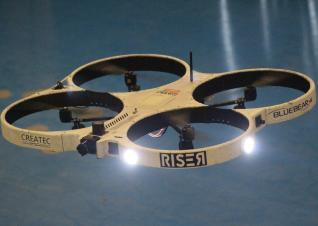
Perhaps one of the worst kept secrets in Silicon Valley, Woodman’s announcement in front of investors and technology executives finally confirmed a new direction for GoPro, which, in the year since its initial public offering, has attempted to portray itself as more than just a camera company. While there’s been talks of GoPro’s forays into media and content, a quadcopter–or more generally, an unmanned aerial vehicle (UAV)–emphasizes that the company can embrace new ideas and products.

“They invented the action camera category and there’s not many more features that they can offer [on the cameras],” said Michael Pachter, an analyst with Wedbush Securities. “GoPro wants to show that it’s innovating.”

With consumer drones, however, GoPro may be innovating as well as playing catch up. The company is behind drone manufacturers like 3D Robotics and Shenzhen, China-based DJI, which sold its first mass market drone in 2013 and is on course to do $1 billion in sales this year. By far the market leader, DJI raised $75 million last month at an $8 billion valuation, larger than GoPro’s current $7.5 billion market capitalization.

While GoPro’s shares are trading at nearly double its IPO price of $24, its stock is down from the dizzying heights of last fall when holiday sales expectations buoyed investor confidence. With its drone, GoPro is hoping to reignite interest in its stock, a move which has worked to some extent with shares jumping 6.5% on the day of Woodman’s announcement.

GoPro’s CEO declined to comment for this article through a spokesperson, but those close to the company said that Woodman has been considering the development of his own drone since mid-2013. For most in the industry, it’s a logical move.

“Consumer and commercial drones are regularly used at sporting events like skiing, snowboarding and surfing–the same places where GoPro rules,” said Bilal Zuberi a partner at Lux Capital. “So it makes sense that GoPro does not want to leave that field open for DJI and others, and hurt its standing as the dominant brand among sports enthusiasts.”

3D Robotics CEO Chris Anderson, whose company has made GoPro its official camera for its new consumer drone, Solo, noted that there is a “natural synergy” between drone enthusiasts and GoPro users.

“What GoPro allows is for people to shoot their lives in cinematic styles, and that’s exactly what drones can offer,” he said.

GoPro’s eventual move into the drone market may put it at odds with current partners like 3D Robotics, who is the first outside company ever to use GoPro’s branding on the packaging on their products. Up until now, drone manufacturers and GoPro have been largely symbiotic, with Anderson roughly estimating that as many as 10% of GoPros purchased today are being attached to UAVs.

Though GoPro could go from a collaborator to a competitor, the 3D Robotics chief said it’s not a move that was entirely unexpected as GoPro had poached his former product management director Pablo Lema last June to head up its drone program. Anderson also said that the drone industry “is not a zero-sum game” and that the entry of quality manufacturers to the market will only grow awareness and interest in the space.
Former DJI North America head Colin Guinn tried to broker deals between DJI and GoPro that never materialized. (Photo: Matthew Mahon for Forbes)

Former DJI North America head Colin Guinn tried to broker deals between DJI and GoPro that never materialized. (Photo: Matthew Mahon for Forbes)

That sentiment is likely not shared by DJI, whose signature consumer UAV line, the Phantom, proved to be an early inspiration for Woodman’s desire to build a drone, said sources. By the middle of 2013, DJI and GoPro were said to be negotiating a variety of deals brokered by then DJI North America head Colin Guinn. Originally, the plan was to develop a drone together, with GoPro providing the branding and sales channels, while DJI offered engineering expertise and manufacturing capabilities.

“Initially [GoPro and DJI] wanted to make a product together for GoPro to sell, but the negotiation never came to fruition,” DJI CEO Frank Wang told FORBES in a recent interview. They treated us like the original equipment manufacturers (OEMs). The deal came out to roughly this: GoPro would make two points of profit, and I’d make one point.”

“They dealt with us like how they dealt with Taiwanese OEMs, so we never had a successful official partnership,” he added.

Sources said that conversations between the two companies would attempt to develop different relationships, with discussions of DJI using GoPro’s established retail channels to distribute its drones. Due to disagreements, however, nothing was ever signed, and DJI lost most of its connection to the American camera maker following the departure of Guinn, who ended up suing his former employer over an ownership dispute in 2014, before moving to 3D Robotics.

These days, even though GoPros are still heavily used on DJI products, CEO Wang has attempted to wean his customers off the American brand. DJI is developing its own cameras, which Wang claims are better than GoPro’s offerings.

“From the beginning to now, we never wanted to be in the shadow of someone else,” he said.

GoPro risks being overshadowed by the likes of DJI and 3D Robotics if it doesn’t move quickly with its drone. Growth in GoPro’s sales, which increased 42% to $1.39 billion in 2014, has slowed after doubling or tripling annually up until 2013. Contrast that with the fast-paced consumer drone market where DJI is expected to double sales this year after closing 2014 with about $500 million in revenue.

Yet before it sells a single drone, GoPro has plenty to do beyond making an announcement. UAVs are far more complex than any camera and require not only hardware, but also proprietary software. Both DJI and 3D Robotics began by developing software autopilots before attempting to build full consumer products.

Sources close to GoPro said there have been at least three different designs for a four-propeller drone and it’s unclear if a decision has been made as to the exact specifications for the device. GoPro declined to give a timeline of when its drone would be ready to ship to consumers. It took seven years from DJI’s founding for Wang to develop and ship the company’s first Phantom. Six years on from its founding, 3D Robotics is just releasing Solo to the market.

“Drones are hard,” said Anderson. “They’re unlike a camera where you can buy sensors on the streets of Shenzhen and put something together. It’s really, really hard to do well and you can’t just buy the parts.”

With reporting Heng Shao in Hong Kong.