Participating individuals, non-participating individuals, and the 500 ft bubble.

500ft-bubble-interesting-man-240x300

This area is causing all sorts of confusion for individuals. How close can you get to people? When can I get within 500ft of a person? Can I fly at a concert or football game? Can I fly over people?

Here is a quote from the exemption from one of my closed-set 333 clients.

26. All Flight operations must be conducted at least 500 feet from all nonparticipating persons, vessels, vehicles, and structures unless:
a. Barriers or structures are present that sufficiently protect nonparticipating persons from the UA and/or debris in the event of an accident. The operator must ensure that nonparticipating persons remain under such protection. If a situation arises where nonparticipating persons leave such protection and are within 500 feet of the UA, flight operations must cease immediately in a manner ensuring the safety of nonparticipating persons; and
b. The owner/controller of any vessels, vehicles or structures has granted permission for operating closer to those objects and the PIC has made a safety assessment of the risk of operating closer to those objects and determined that it does not present an undue hazard.
The PIC, VO, operator trainees or essential persons are not considered nonparticipating persons under this exemption.

The exemption does not indicate if this is a slant angle 500ft bubble or a  500ft ground circle. Functionally, there isn’t much of a difference here. If you look at the graph I created, at 200 ft (the max height for a blanket COA), the closest ground distance would be 458.3 ft. There is a 41.7 foot difference in interpretation. The two different interpretations only start mattering once you can start operating above the blanket COA.

The 500ft bubble is a pretty big bubble. Here is a graph of a 500ft slant angle bubble.

graph of 500 foot bubble in 333 exemption


This bubble is going to prevent many urban and “in town” operations; however, later in the exemption’s conditions and limitations only applicable to operations for the purpose of closed-set motion picture and television filming and production, it says:

31. Flight operations may be conducted closer than 500 feet from participating persons consenting to be involved and necessary for the filming production, as specified in the exemption holder’s MPTOM.

Mere aerial data collection operations do NOT have these conditions. Closed-set acts like an “upgraded” version of aerial data collection.

So then who is a participating individual?

The FAA defines Participating Person/Authorized Person as,  “All persons associated with the filming production must be briefed on the potential risk of the proposed flight operation(s) and they must acknowledge and accept those risks.Nonparticipating persons are the public, spectators, media, etc., not associated with the filming production.

The only way you are going to get within 500ft is if the people are participating people, you are cleared for closed-set operations, and you are abiding by your motion picture manual.

http://jrupprechtlaw.com/

FAA: Local drone near Obama had Coast Guard, Secret Service on alert

nicequadclose

Mike Stucka

A branch of the U.S. military had to send a warning about a local drone — because it was flying near President Barack Obama as he played golf.

Newly released reports from the Federal Aviation Administration show that local drone incidents are happening at a rate of about once a month now. The March 29 incident with Obama doesn’t say how close the drone was or whether foul play was suspected.

The U.S. Secret Service called the FAA to report that the U.S. Coast Guard had spotted a drone flying “in the vicinity of POTUS,” the President of the United States. A Coast Guard spokesman in Miami said he had no information on the incident. The Palm Beach Post has filed a Freedom Of Information Act request for records on the incident.

According to The Washington Post, Obama spent that weekend playing at the members-only Floridian National Golf Club in Palm City, across the St. Lucie River from Stuart.

Perhaps the most serious threat came on the evening of July 4, when the risk was a drone rather than errant fireworks. A JetBlue regional jet from Boston saw a black and white drone with four rotors flying at 1,500 feet about three-quarters of a mile south of Palm Beach International. He did not have to take evasive action. That kind of jet can carry about 100 passengers.

And less than two weeks ago, on Aug. 15, the pilot of a Cessna 172 said he passed 100 feet from a quad copter as he was preparing to land. Aircraft traffic controllers redirected traffic to steer them away from the area. The incident happened about 2,000 feet up, or nearly half a mile, with both aircraft at the same height.

The FAA report suggests the incident wasn’t an accident.

“Pilot contacted tower after landing,” the FAA notes, “and stated the drone appeared to have a camera suspended under it and maneuvered to follow the Cessna.”

More drones were suspected of being a threat, both at high altitudes and lower, but close to airport flight paths.

In November, the Palm Beach County Sheriff’s Office launched helicopters several times in unsuccessful efforts to find drone pilots close to runways. In one Nov. 28 call, deputies spent a half hour looking for a drone flying over the approach end of a Palm Beach International Airport runway. In the November incident, drones were spotted by at least four aircraft, who said the drone was about 700 or 800 feet up. Neither the deputies in the helicopter, nor Palm Beach police officers, found the drone or its pilot.

A month later, deputies spent about 25 minutes looking around U.S. 441 for a drone in the final approach path into Palm Beach International Airport. A caller told the FAA that the drone had been orbiting the area, and the FAA said Palm Beach County deputies were also searching the ground.

Another drone was spotted in April by the pilot of a business jet, who was on his final approach into Palm Beach International when he spotted a drone hovering at 200 feet. He did not have to swerve.

One drone was spotted on the morning of June 15, when a pilot in a single-engine propeller airplane spotted a silvery drone just half a mile north of Palm Beach International, flying at about 1,500 feet. Deputies again flew out to search around Okeechobee Boulevard for the drone and its pilot, but didn’t find either.

Another pilot reported seeing a five-foot long black drone at 13,000 feet over Martin County.

Another pilot in a Gulfstream jet flying to New Jersey said he “came within 20 feet of a good-sized, fast-moving opposite direction white (drone) with wings” at 25,500 feet about 50 miles east of Palm Beach International.

http://www.palmbeachpost.com/news/news/local/faa-local-drone-near-obama-had-coast-guard-secret-/nnQKN/

Texas: New drone laws start Sept. 1

phantomstatue

By Garrett Brnger

SAN ANTONIO – Drone use is taking off around the United States, and the Texas Legislature is among the state governments trying to keep up.

Texas lawmakers passed three laws on unmanned aircraft – more commonly referred to as drones – in the past legislative session, and they will go into effect September 1. The laws restrict use in certain areas and increase the occasions when a drone pilot can take pictures.

FAA guidelines require authorization to use drones for commercial use, and Texas state law already allows the aircraft to take pictures under certain conditions. Lawmakers expanded those conditions to include more broad academic purposes and add engineers and surveyors to the list.

“There are a lot of early movers experimenting with it, learning the technology, so they’re ready when the rules do come in place,” said Mark Paulson, a drone salesman for G4 Spatial Technologies.

Paulson is also a licensed surveyor. Demonstrating the capabilities of an eBee fixed-wing drone, he said the aircraft and their software are more accurate than traditional surveying methods. Instead of a 50-foot square, you get a 3D model every 1.3 to 1.5 inches.

They’re also a lot faster. For example, take a 100-acre aerial photo and topographical survey.

“Typically, that would take a day-and-a-half to three days in the field and a day or two in the office for processing,” Paulson said. “The drone, you can do the complete process in about eight hours.”

With the capabilities of drones expanding, Paulson believes it won’t be long before every engineer and surveyor is using one.

While everyone may be using these drones soon, they won’t be using them everywhere.

Lawmakers also barred drone pilots from flying them too close to “critical infrastructure facilities” like power plants or gas processing plants. Flying less than 400 feet above the ground over these facilities, close enough to interfere with their operations or making contact with it or anybody on the property will earn the drone pilot a Class B or Class A misdemeanor, depending on what number offense it is.

It appears legislators also want some distance from drones. The third law they passed allows the DPS director to either prohibit or limit the use of drones above the Capitol Complex. Those rules need to be in place by Dec. 1.

Any drone operators, commercial or recreational, should keep safety mind. Though piloting an unmanned aircraft near airplanes or helicopters is illegal, the FAA said pilots have already reported 650 drone sightings as of Aug. 9. That’s compared to 238 sightings in all of 2014.

Additionally, David Leal, a technician at Hobby Wireless in San Antonio, pointed out that anything that falls off the drone is coming down, possibly onto the pilot or someone else.

“Some of these things, like the larger platforms can carry up to about a 15 lb load or more,” Leal said. “That’s a lot to rain down on your head.”

============

For more on FAA regulations on drones, click here.

Read the new state laws on drones here:

HB 1481 http://www.legis.state.tx.us/tlodocs/84R/billtext/html/HB01481F.htm

HB 2167 http://www.legis.state.tx.us/tlodocs/84R/billtext/html/HB02167F.htm

HB 3628 http://www.legis.state.tx.us/tlodocs/84R/billtext/html/HB03628F.htm

http://www.ksat.com/news/new-drone-laws-start-sept-1


The drones of tomorrow

Unmanned aerial vehicles need enabling regulations

Business Standard Editorial Comment  |  New Delhi  August 22, 2015 Last Updated at 21:40 IST

One of the challenges of wedding photography is videotaping the procession as it starts its journey from the groom’s house. However, of late an increasingly common solution has been the deployment of a camera-drone. It allows for unusual and interesting angles of coverage. are also covering fashion shows, political rallies and concerts. And there is much talk of using them to deliver pizza. Clearly, drones, or (UAVs), are now well and truly part of everyday life. The cost of owning and operating one is roughly equivalent to a mobile phone. Many UAV models are available off the shelf, with prices between Rs 3,000 and Rs 1.5 lakh. Of course, the military and security uses are well-known. The Indian security establishment is said to deploy more types of drones – at least 50 different models – than any nation other than the USA. The police use for monitoring religious processions and gatherings such as those during Ganesh Chaturthi, Ramzan, the Kumbh Mela and so on. The deployment of UAVs which can spray tear gas on rioters is also under consideration.

But UAVs can also perform a very wide range of civilian tasks. They are used for mapping and surveying, and gathering meteorological, environmental and oceanographic data. Spraying of crops with pesticides and fertilisers was pioneered by Japanese farmers. UAVs are also deployed for monitoring activity in forests, and in disaster relief. They can be used to deliver food and medicine across difficult terrain, or to provide Internet connectivity. Given increasingly sophisticated technology and human ingenuity, the sky is literally the limit when it comes to figuring out new usages for drones. There is a domestic industry with at least 25 local UAV manufacturers, and many start-ups offering software and associated technological products and services. There is even a lobby: the Unmanned Systems Association of India.

Obviously, there are concerns about safety, security and privacy. Accidents could happen, or UAVs could be used deliberately to cause harm in many ways, or to spy on people. But blanket bans would be impossible to enforce, apart from being retrogressive in spirit. What is needed are modern regulations; but there are no regulations governing the use of UAVs, either by government agencies, or by private citizens and companies. As of now, the civilian UAV sector operates under the constraint of almost absurd regulations, which were released in October 2014. In theory, every civilian user is supposed to seek permission for every UAV flight from both the (DGCA), and the Ministry of Home Affairs. In practice, these regulations are unsurprisingly, often ignored. It is easier to “request” local police to look the other way. The security implications are terrifying.

The is said to be formulating draft regulations for civilians, based on the regulations of the American (FAA). The licenses civilian use of UAVs weighing less than 25 kg, which can be flown at heights of up to 150 metres (or 492 feet) and at speeds of up to 160 kilometres an hour. Flights are restricted to line-of-sight. Commercial operators may apply for renewable permits. No-fly zones are also defined. But even the FAA regulations have been criticised as constricting. UAVs can fly much higher, at far greater speeds, and safely out of line-of-sight. But if the DGCA does release a draft, the details could be thrashed out via the usual consultation process. The regulations would have to be subject to review as technology improves. It also behoves the government to set transparent, clearly defined limits on the use of UAVs by its own agencies, given the privacy implications. UAVs provide classic examples of technology which can be both disruptive and enabling. There are enormous potential benefits but there are also obvious dangers. Regulation is absolutely necessary but it must be flexible and guided by common sense.


http://www.business-standard.com/article/opinion/the-drones-of-tomorrow-115082200821_1.html

The US government is working on a system to knock commercial drones out of the sky

 David Morgan, Reuters

An Aeronavics drone sits in a paddock near the town of Raglan, New Zealand, July 6, 2015. REUTERS/Naomi TajitsuThomson ReutersAn Aeronavics drone sits in a paddock near the town of Raglan, New Zealand

WASHINGTON (Reuters) – As concerns rise about a security menace posed by rogue drone flights, U.S. government agencies are working with state and local police forces to develop high-tech systems to protect vulnerable sites, according to sources familiar with the matter.

Although the research aimed at tracking and disabling drones is at an early stage, there has been at least one field test.

Last New Year’s Eve, New York police used a microwave-based system to try to track a commercially available drone at a packed Times Square and send it back to its operator, according to one source involved in the test.

The previously unreported test, which ran into difficulty because of interference from nearby media broadcasts, was part of the nationwide development effort that includes the Department of Homeland Security, the Federal Aviation Administration and the Defense Department, the source said.

The sources were not authorized to speak about the effort and declined to be identified.

Asked about the development of counter-drone-technology, the Department of Homeland Security said it “works side-by-side with our interagency partners” to develop solutions to address the unlawful use of drones. Officials with the Defense Department, FAA and New York Police Department declined to comment.

But the sources acknowledged that efforts to combat rogue drones have gained new urgency due to the sharp rise in drone use and a series of alarming incidents.

The number of unauthorized drone flights has surged over the past year, raising concerns that one could hit a commercial aircraft during landing or take-off, or be used as a weapon in a deliberate attack, the sources said.

Drones have flown perilously close to airliners, interfered with firefighting operations, been used to transport illegal drugs into the United States from Mexico, and sparked a security scare at the White House, among other incidents.

Drone Ng Han Guan/AP Images


LIMITED POWERS

But U.S. authorities have limited tools for identifying drone operators, many of them hobbyists, who violate federal rules that drones fly no higher than 400 feet (120 meters) and no closer than 5 miles (8 km) to airports. One reason for the enforcement gap is that Congress in 2012 barred the FAA from regulating recreational drones.

A system capable of disabling a drone and identifying its operator would give law enforcement officials practical powers to block the flights.

At crowded venues such as Times Square or the Super Bowl, police want to be able to take control of a drone, steer it safely away from the public and guide it back to the operators, who can then be identified, the sources said.

A Reuters analysis of FAA data shows that authorities identified operators in only one in 10 unauthorized drone sightings reported in 2014, while only 2 percent of the cases led to enforcement actions.

“We can’t shoot it out of the sky. We have to come up with something that’s kind of basic technology so that if something happens, the drone or device will just go right back to the operators. It won’t crash,” one of the sources said.

To do that, experts say that a drone needs to be tracked and identified with a receiver and then targeted with an electromagnetic signal strong enough to overwhelm its radio controls.

“You need enough power to override the transmitter. If I just jam it so it can’t receive signals, it’s probably going to crash. But if I know the transmission codes the drone is using, I can control that object,” said retired U.S. Marine Lieutenant Colonel Muddy Watters, an electronic warfare expert.

Laws governing the use of drones have lagged their dramatic rise in areas spanning agriculture, filming and recreational use. Recreational drone operators are not required to register their machines, obtain training or put identifying features on the aircraft, making it extremely difficult for police to track down rogue operators.

drone-ban-mapMapBoxWhere drones are banned.

FIRE-FIGHTING DISRUPTION, SECURITY SCARES

U.S. pilots have reported more than 650 drone sightings this year, as of Aug. 9, well over double the 238 total for all of 2014, the FAA said last week.

More than 1 million drones of all kinds are expected to be sold in the United States this year, compared to 430,000 in 2014 and 120,000 in 2013, according to the Consumer Electronics Association.

In California, errant drones forced firefighters to suspend air drops of water and fire retardant on wild fires this summer.

In January, a “quadcopter” drone landed on the White House lawn after its operator lost control of the device in downtown Washington. Federal officials decided not to bring criminal charges.

Police say their greatest fear is weaponization, as the advance of drone technology enables the unmanned aerial vehicles (UAVs) to travel farther and faster and carry larger payloads.

Guns can be fixed to drones and fired with relative ease, as demonstrated in a popular video posted to YouTube by a Connecticut teenager in July. The 15-second video, entitled “Flying Gun”, shows a quadcopter hovering just above the ground in a wooded area and jerking backward with each of four shots.

The case is under investigation by the FAA to determine whether the drone violated aviation safety rules.

Safety and security concerns have prompted bipartisan discussions in Congress about options that include federal support for jamming drone systems and other potential technology solutions.

Senator Charles Schumer, a New York Democrat, proposed this week that drone manufacturers be required to install technology capable of preventing the unmanned aircraft from straying near “no fly” areas such as airports.

Drone industry executives say that one possible solution is an industry-wide agreement to include so-called “geo-fencing” software in drones to prevent them from straying above the legal altitude or too close to sensitive sites.

Chinese drone maker SZ DJI Technology Co Ltd, whose drone was involved in the January crash on the White House grounds, has since released a software fix that will restrict flights around sensitive areas.

Federal authorities say they are also prepared to bring federal criminal charges against rogue drone operators who violate FAA restrictions.


(Additional reporting by David Alexander, Andrea Shalal and Doina Chiacu; Editing by Soyoung Kim and Stuart Grudgings)

Albrecht leading effort to open doors for drone use by emergency responders

marcalbrecht

By JOSH MOODY Hub Staff Writer

KEARNEY — Grounded — that’s where professors at the University of Nebraska at Kearney find their research into unmanned aerial vehicles.

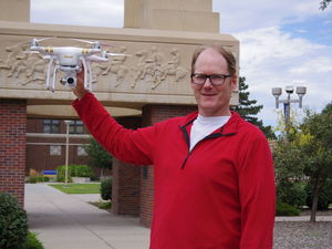
“What we’re proposing is to create a system of drone use and drone training by emergency responders in Nebraska,” UNK biology professor Marc Albrecht said. Federal Aviation Association regulations are keeping UNK’s three drones on the ground.

Better known as drones, unmanned aerial vehicles, are being used in agriculture, construction, weather prediction, warfare and in other ways.

One way that Albrecht sees drones being used in the future is by first responders in emergency management situations. Albrecht said drones could be used to examine fires, floods and other dangerous situations.

The proposed training would take place at UNK’s Nebraska Safety Center, which offers training classes and certification courses for specialized licenses.

Albrecht said that the training would be a complete package, teaching the hardware, software and regulations guiding the use of drones.

“A private citizen may not be worried about flying a drone legally, especially if they’re on their land. But if you’re an emergency responder, you are going to be flying over other people’s property, potentially in dangerous situations, and there’s going to be people around probably, if not equipment and power lines. So, you actually have to be more aware of the regulations than just a hobbyist or even a rancher on his own land,” Albrecht said.

UNK’s drones — a DJI Phantom 3, a DJI Inspire and a 3DRobotics Solo — were purchased along with other support equipment with an $18,624 research grant.

“The FAA regulations are changing very rapidly. They’re changing as to where and when and how you can use drones all the time,” Albrecht said.

Terry Gibbs, director of UNK’s aviation systems management program, also is part of the research team and is lending his expertise on FAA regulations.

“What I’m doing primarily is helping individuals — faculty members and (the University of Nebraska) systemwide — navigate how to use this tool legally,” Gibbs said. He is working with the university to determine and mitigate risks in drone operations.

“I believe there is a tremendous amount of potential,” Gibbs said. “I don’t think it’s going to take away from manned aviation. I think it’s going to add another layer of aviation and just change the whole paradigm of how we do things. I’d like to be part of discovering that process.”

Though operating drones for university research is not permitted by the FAA, Albrecht said the research project will continue with the goal of establishing a training system for emergency responders. However, the researchers won’t have a chance to learn hands-on with the equipment.

“These are certainly interesting devices. They certainly open up new possibilities for research. They are being used today by agencies and by people, so it’s a little frustrating to physically have them and not be able to do that. But it doesn’t stop our effort. It doesn’t halt it,” Albrecht said.

Gibbs said the FAA’s primary concern about drones is to protect manned aircraft pilots from danger caused by drones.

He is concerned for the safety of pilots in the agricultural industry — an area in which drones are beginning to creep into.

“When people are putting these things up over their fields — I believe it’s a valid use, but remember, I want to caution them that where these things (drones) are flying is exactly where the ag pilots are flying,” Gibbs said.

Gibbs said while the collision between a drone and an airplane would likely cause minimal damage, a startled pilot could lose control in air.

“What will a 5-pound drone do to an airplane? Probably not a lot. But in the event of the ag person who’s flying along at 15-20 feet off the ground at 140 knots and he sees this thing all of a sudden pop up, what is his reaction going to be?”

Though barred from operating drones, the research into providing a training system for emergency personnel continues.

“It’s a little disappointing because I would like to work with them. They seem like an interesting tool. But these things happen. I guess that’s part of the price of trying the new tools and trying to keep up with the times. Sometimes, as a person who is working in an institution, you have to wait for legal frameworks and regulation to catch up,” Albrecht said.

According to Albrecht, the research will likely take one year of learning and preparation and another year for review and implementation.

Drones in the classroom

Another area off-limits to Albrecht is using drones in the classroom.

“I like technology. I think bringing something new to the classroom is engaging for students,” he said. “I had hoped to use drones in teaching, simply to keep up with the technology, interest students and introduce them to this new tool.”

As a biologist and ecologist, Albrecht sees the potential field use for drones.

That potential for drones has been recognized by the U.S. Department of the Interior, the Bureau of Land Management and the United States Geological Service. All use drones for tasks such as mapping remote areas, land management and monitoring wildlife populations.

The Section 333 exemption

One option for researchers is to apply for a Section 333 exemption, which would allow them to operate drones with FAA permission.

The problem, Gibbs said, is that these exemptions are rare.

To date, the FAA has granted 1,008 Section 333 exemptions.

Those exemptions have largely gone to real estate agencies, insurance companies, and organizations conducting aerial photography and videography.

Entities granted exemptions include Amazon.com, BNSF Railway, CNN, Liberty Mutual Insurance, State Farm, Union Pacific Railroad and Yamaha Motor Co. Hobbyists are not required to obtain a Section 333 exemption.

“You as a private citizen, for your own hobbyist use, can go out and fly them around all you want to,” Gibbs said.

The rule-making process

In February, the FAA announced a proposed regulatory framework for drones less than 55 pounds. Rules for larger drones will be considered in the future.

Following the proposal, the FAA accepted public comments for 60 days. The comment period ended in April, and the review process continues.

Included in the proposed rules are a number of safety measures designed to keep drones from interfering with manned aircraft in shared airspace.

“This is a transformative technology,” Gibbs said. “The problem is, literally, that the technology is moving faster than the rules.”

Albrecht said it is important that the university be part of the discussion about drone regulations.

“It’s law lagging behind technology,” Albrecht said. “I hope that the FAA and insurance companies allow space for education to get into the mix.”

http://www.kearneyhub.com/unk-today/albrecht-leading-effort-to-open-doors-for-drone-use-by/article_21a87bd8-48ee-11e5-97bb-ff2a99cd06a6.html

AMA issues drone challenge

August 20, 2015

Students in the AMA UAS4STEM program will build quadcopters similar to the one pictured here, seen at a recent, unrelated event in New York. Photo by Jim Moore.

Students across the country are invited to team up for a new challenge from the Academy of Model Aeronautics, building and flying small unmanned aircraft for a search-and-rescue missions and learning a little science, technology, engineering, and math along the way.

Quadcopter kits available through the UAS4STEM program will be available in the fall, and teams of up to eight can register online now. Training, insurance, equipment, entry fees, and AMA memberships are all included in the $1,995 cost per team. Everything needed to build and support a Quadzilla quadcopter is included in the kit, though teams will need to supply their own laptops. Online training will cover the safe (and legal) operation of the unmanned aircraft, and the coursework is mandatory (it must be completed before the kit is shipped to the team). Participants will have access to online videos explaining how to build and fly the quadcopter, and prepare to use it to find lost hikers.

AMA flying sites around the country will host the search-and-rescue challenge in the spring of 2016, tasking the students with searching a predefined area for hikers lost in a remote area.

 AMA “continues to embrace new technology and increase its educational efforts,” the organization noted in a press release, and has granted nearly $900,000 to date in scholarships for youth members pursuing higher education. The organization has about 50,000 youth members participating in its education programs.

AOPA has joined AMA, the FAA, and other organizations supporting the Know Before You Fly campaign designed to educate unmanned aircraft operators about safe operation and regulations. The campaign, which also features a mobile app designed for operators that allows them to verify the legality of a particular flying location, is part of a larger effort to stem the irresponsible and dangerous behavior of many consumers who have flown their drones in restricted areas, near airports, and within the National Airspace System.

http://www.aopa.org/News-and-Video/All-News/2015/August/20/AMA-issues-drone-challenge

Senator to introduce proposal for mandatory drone geofencing

By John Ribeiro

CMU Crossmobile drone

CMU Crossmobile drone
Credit: Carnegie Mellon University
Schumer is concerned about so many near-collisions of drones flying into planes

U.S. Sen. Charles Schumer (D-N.Y.) is to introduce a proposal soon that aims to make geofencing of drones mandatory, following a number of reports of close shaves between the unmanned aircraft and regular planes.

The geofencing of drones would use GPS and other technology to impose geographical limits on their movement.

Schumer said Wednesday he would propose an amendment as part of the Federal Aviation Administration (FAA) Reauthorization Bill that must move through Congress this fall, to require manufacturers to have in place geofencing technology “or other similar solutions” on all drones to prevent them from flying in prohibited zones like airports.

The amendment is necessary as reports suggest that the FAA’s current policy will be extended through at least 2016 without a provision for geofencing, Schumer said.

The technology already exists for preventing drones from flying into unauthorized areas. DJI, the manufacturer of the drone that crashed on the lawn of the White House in January, announced soon after that it would release firmware that would add a no-fly zone around much of Washington.

Concern has been increasing about possible collisions between rogue drones, flown by hobbyists and enthusiasts, and traditional aircraft. By FAA rules, hobbyist drones cannot weigh more than 55 pounds (25 kilograms), and have to be flown at below 400 feet (about 122 meters), within visual sight of the operator, and 5 miles (8 kilometers) away from airports.

But the FAA rules have often been breached. Data released by the FAA last week said that pilot sightings of drones have picked up from 238 throughout 2014, to more than 650 in a little over seven months of this year. And 138 pilots, flying a variety of aircraft including large commercial air carriers, said they had seen drones at altitudes of up to 10,000 feet during the month of June, and another 137 pilots had similar experiences to report in July. The corresponding numbers for June and July last year were 16 and 36, respectively.

Last month, drones were found obstructing the fighting of a wildfire in California, to apparently shoot videos. As of July 31, there were nearly 10 reported near-collisions involving drones and airplanes in the New York metro area, according to Schumer. Three of these incidents happened at John F. Kennedy International Airport, four were at Newark Internation Airport and all involved passenger jets carrying hundreds of people, he added.

The FAA proposed rules earlier this year that could allow programs like those of Amazon.com for the commercial delivery of packages by drones to take off. But the drones will still have to operate under restrictions such as a maximum weight of 55 pounds and follow rules that limit flights to daylight and visual line-of-sight operations.


http://www.computerworld.com/article/2973953/emerging-technology/senator-to-introduce-proposal-for-mandatory-drone-geofencing.html


How to Officially Report Your Drone Flight Plans to Nearby Pilots

Let other pilots know where you’re gonna be in the air up there.
By Chris Clarke

U.S. pilots are lucky enough to have free access to an abundance of flight information via Flight Service Stations since the 1920s. This service is generally used to check weather along a desired route and to file and close flight plans. Now with the proliferation of drones flying in the same airspace as regular airplanes, the service is integrating information on unmanned flights as well, and you can participate.

For the majority of its existence, Flight Service for pilots was accessed by a phone call to your local station. You’d be connected with a local briefer who would have intimate knowledge of local weather patterns and airport procedures, and could inform you of any closed runways or inoperative approach lights. After you were satisfied that you’d received enough information pertaining to your flight, you could then file a flight plan while you were still on the line. It was very common to call hours before your flight to get an outlook briefing and then again right before departure to check if any major changes might have popped up.

In more recent years, this job has been handed over to Lockheed Martin, who has been hard at work consolidating information into a nationwide system to more quickly and automatically disseminate information to pilots. To accomplish this, Lockheed Martin has implemented an Adverse Conditions Alerting Service to automatically send pilots alerts for things like newly forecasted severe weather, newly restricted airspace due to government or military activity, or things like a high density of aerial firefighting activity. In the wake of rising reports by pilots of drone sightings, Lockheed Martin has added Unmanned Aerial Systems (UAS or drones) flight areas to this alerting service as well.

If you happen to be one of the roughly 1,200 commercial drone operators to receive an exemption from the Federal Aviation Administration (FAA) to fly in the national airspace system, then you are required by law to declare your intended flight by filing a plan with Flight Service. The “hobbyist” and fly-by-night drone operators are also encouraged to participate in the system too, hopefully limiting the chances of a mid-air collision.


http://www.popularmechanics.com/flight/drones/a16987/how-to-officially-report-your-drone-flight-plant-to-nearby-pilots/

Knock, Knock. Your UAV Was There

If technology can make it possible to catch irresponsible drone operators in the act while improving flight safety for manned and unmanned aircraft, shouldn’t we be using it?

Normally I don’t like to visit the same subject two weeks in a row, but a brief conversation with the FAA this week and a couple interviews for an upcoming article got me to thinking about drone safety once again.

I called Les Dorr at the FAA to ask him about the agency’s recent warning to drone operators. Because of a large spike this year in the number of pilots who’ve reported seeing UAS near their aircraft, the agency wants drone operators to know that flying too close to manned aircraft can result in the FAA levying civil and criminal penalties.

The FAA’s concern is understandable, although it begs the question: How successful has the agency (or anyone else, for that matter) been in catching and taking action against reported violators? After all, in 2014 and this year, there have been nearly 900 pilot reports. But after saying that the FAA has initiated more than 20 enforcement cases, Dorr added: “Several of the cases involve UAS operating near other aircraft.”

Dorr explained how difficult it is to actually catch a drone operator flying in restricted airspace, even when a pilot report is fairly specific. By the time the FAA notifies the proper local law enforcement agency and an officer can be sent to the area, there’s a good chance the offending party will no longer be there. And even if he or she is, it’s often difficult to spot the drone pilot from the ground.

So the likelihood of a UAS airspace violator getting caught and suffering the consequences is quite low. As with Internet communications, anonymity has a tendency to cause people to say and do things that they usually wouldn’t. As long some—probably a few—UAS pilots know that there’s little chance of getting caught, they don’t feel compelled to observe airspace restrictions.

And that leads me to another discussion I had this week with Paul Jauregui of the Praetorian Group and Chris Eyhorn with DroneSense. Praetorian—a security firm—and DroneSense—a UAS startup company—partnered on a project to survey how many electronic devices in Austin, Texas, are connected to the Internet. A sensor developed by Praetorian was installed on an unmanned aerial vehicle (UAV) owned and operated by DroneSense, which flew it over sections of Austin.

Essentially, the drone-mounted sensor interrogated the Internet-connected devices through the ZigBee Wi-Fi standard they use. Using this data, Praetorian created a map showing the types of devices and where they’re located. This data can help Praetorian develop better methods to keep Wi-Fi networks secure.

What does this have to do with UAS safety and catching irresponsible drone pilots in the act? If an airborne sensor light enough to be carried by a small UAS can obtain information from an Internet-connected device the size of a lightbulb in a building on the ground, why can’t similar technology be used to link a drone to its owner?

It occurs to me that we have the technology to help solve the UAS safety problem. Every UAV sold should be equipped with an embedded chip that contains an electronic ID number registered to the aircraft owner. The information should be uploaded to an FAA database.

A sensor similar to the one Praetorian has developed could be installed on commercial aircraft operating in high-traffic areas or be made available to law enforcement agencies. At the touch of a button, the sensor would record the UAV’s ID number, as well as the time of the contact and the GPS coordinates of where it occurred.

Would UAS operators be as bold about pushing the regulatory envelope if they knew there was a good chance the FAA or a law enforcement operator might coming knocking on their doors? I think not.

http://www.uasmagazine.com/blog/article/2015/08/knock-knock-your-uav-was-there